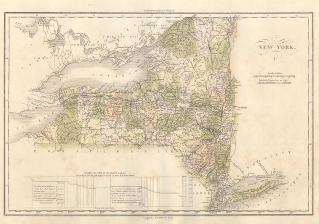
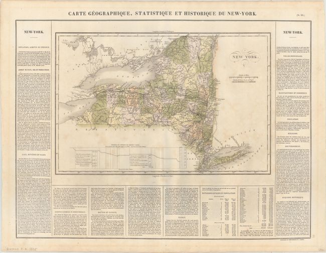
Subject: New York
Period: 1825 (published)
Publication: Atlas Geographique, Statistique, Historique et Chronologique…
Color: Hand Color
Size:
17.6 x 11.6 inches
44.7 x 29.5 cm
This striking map of New York is from the French edition of the Carey and Lea atlas. It includes a Profil du Niveau du Grand Canal (a profile depicting the levels of the Erie Canal) and descriptive text concerning the topography, natural curiosities, history, population, government, and more. Counties, roads, towns, rivers, and canals are included on map. Hamilton and Herkimer counties are labeled Pays Sauvage et inhabite (Wild and Uninhabited Country). County development is current for 1822 as indicated by the shape of Franklin County and the recent organization of Erie, Monroe, and Livingston counties. Buchon's maps were printed on better quality paper than its American counterpart. Measures 24.1 x 18.6" with text.
References:
Condition: B+
Light scattered foxing with faint mat burn confined to the blank margins. There are remnants of hinge tape on verso.