Catalog Archive
Auction 165, Lot 268

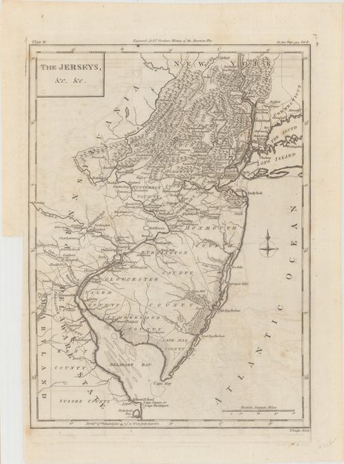
"The Jerseys, &c, &c", Conder, Thomas

Subject: New Jersey

Period: 1788 (circa)

Publication: The History of Rise, Progress and Establishment of the…United States

Color: Black & White

Size:
9 x 12.1 inches
22.9 x 30.7 cm
Download High Resolution Image
(or just click on image to launch the Zoom viewer)

Fine, early map of the state with much information including many towns, villages, roads, watershed and counties,and topographical information. The map extends to show New York City, parts of Long Island and Connecticut, and the Delaware Bay. The Whorekill Road is named, ending at Lewes. Important Revolutionary War places are marked with icons and some dates. Published in William Gordon's The History of Rise, Progress and Establishment of the Independence of the United States.

References: Howes #G256.

Condition: B+

Issued folding on watermarked paper with light offsetting and a few faint spots of foxing.

Estimate: $300 - $375

Sold for: $150

Closed on 11/15/2017

Archived