Subject: Maine
Period: 1838 (published)
Publication:
Color:
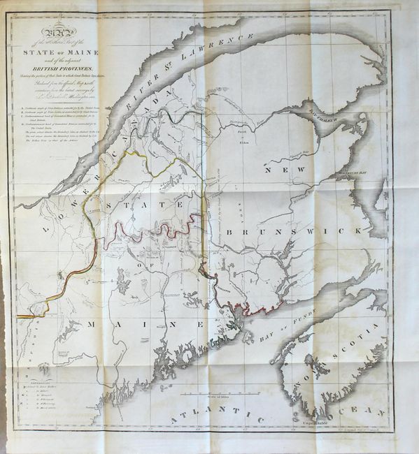
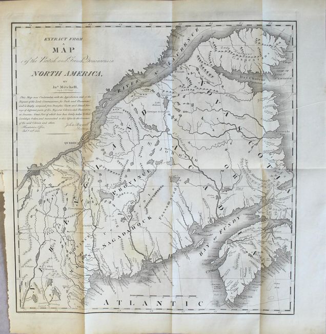
The first map details the boundary dispute between the United States and Great Britain relating to Maine. Hand coloring is used to show the boundary as claimed by the United States and by Great Britain, with a third line labeled "that of the Arbiter" which closely corresponds to Maine's present-day border with Canada. A table gives the major points of contention in this border dispute. Another table names land grants belonging to six land holders. The second map is in black and white and was included for historical purposes. It was extracted from Mitchell's map of 1755 by W.J. Stone. Both maps are still bound into the 8vo, 46 page, disbound Senate report.
A. Map of the Northern Part of the State of Maine and of the Adjacent British Provinces..., by S.L. Dashiell, hand color (15.8 x 17.3").
B. Extract from a Map of the British and French Dominions in North America, by John Mitchell, black & white (13.4 x 13.8").
References: Claussen & Friis #219 & #220; Phillips (M) p. 384.
Condition: B
The first map features original outline color. Both maps were issued folding and have offsetting and light toning. Text is very good with a bit of foxing. Report is housed in a plastic report cover.