Subject: Iowa
Period: 1844 (circa)
Publication: A New Universal Atlas
Color: Hand Color
Size:
13.2 x 15.9 inches
33.5 x 40.4 cm
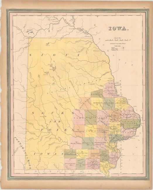
This map of Iowa Territory depicts 31 counties clustered along the Mississippi River in the southeast. There are a number of early settlements and roads confined to this region. The majority of the territory is divided among Indian nations: the Sioux in the north, and the Sauks and Foxes, Iowas and Pottawattamies in the south - separated by a large swath through the middle labeled Neutral Ground. County development is current to circa 1844 with the recent creation of Black Hawk County (1843), and prior to the formation of Marion County (1845). The map was published by Carey & Hart just prior to Iowa's admission as a state.
References:
Condition: B+
Original color with minor scattered foxing and toning along the sheet edges. There are remnants of hinge tape on verso.