Subject: Chicago, Illinois, Lake Michigan
Period: 1840 (published)
Publication: Sen. Doc. 140, 26th Congress, 1st Session
Color: Black & White
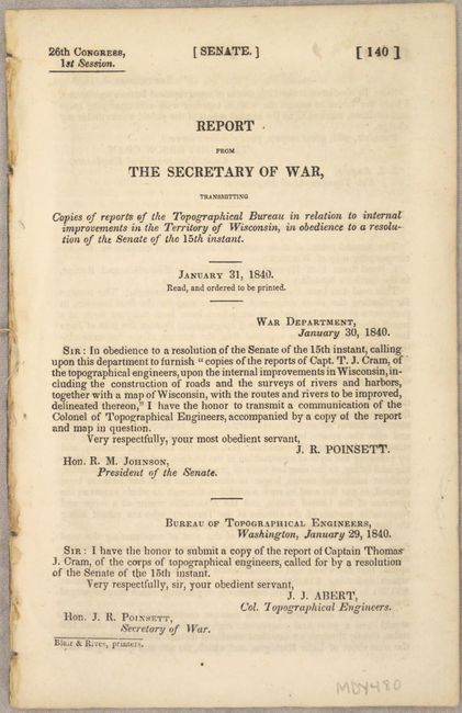
These four early maps of Chicago were issued in the 26-page Report from the Secretary of War, Transmitting Copies of Reports of the Topographical Bureau in Relation to Internal Improvements in the Territory of Wisconsin..., by Captain Thomas Jefferson Cram of the Topographical Engineers (report included). Cram (1804-1883) was born in New Hampshire and graduated fourth in his class from the United States Military Academy in West Point, New York. In 1838, he joined the U. S. (Army) Topographical Engineers, where he received a captain's commission and was assigned to the Great Lakes harbor surveys. In the 1840s he surveyed the Michigan and Wisconsin boundary, and in 1855 he became Chief of the Topographical Engineers, Western Division. He was promoted to Lt. Colonel in 1861, served with distinction in the Civil War and was rewarded with the title of Brevet General in 1866. He retired in 1869. The maps include:
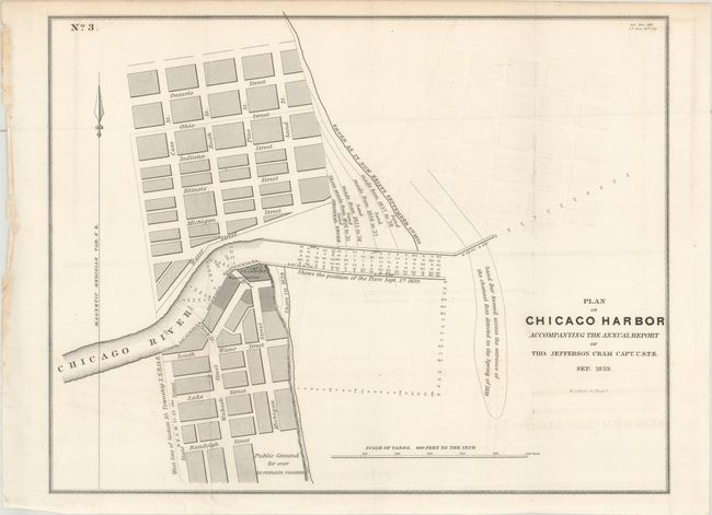
A. Plan of Chicago Harbor Accompanying the Annual Report... (14.0 x 10.9"). An early map of Chicago zoomed in to the Harbor. Part of the city is shown in plan form, and several streets are named. An area south of Randolph Street is Public Ground for ever to remain vacant. The map identifies Fort Dearborn and a lighthouse by the bend of the Chicago River. It also depicts the position of the pier and of the shore as they existed on September 1st, 1839.
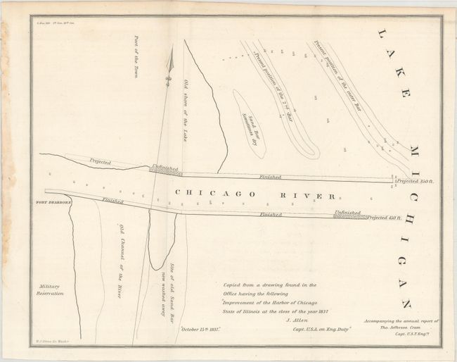
B. [Improvement of the Harbor of Chicago State of Illinois at the Close of the Year 1837] (11.9 x 9.6"). This untitled map of where the Chicago River meets Lake Michigan was apparently copied from "a drawing found in the Office" made by Captain J. Allen in 1837. In a sparse style it shows the old shore of the lake, an old channel of the river, sand bars, a military reservation, Fort Dearborn, and finished, unfinished, and proposed sections of the harbor.
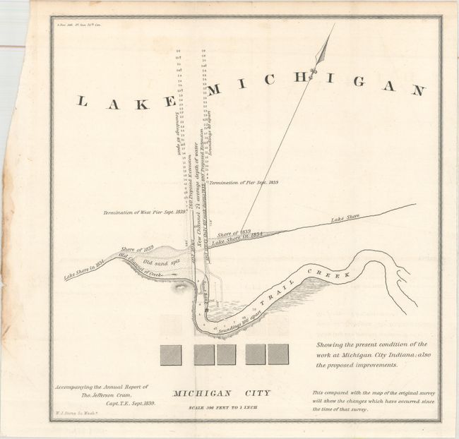
C. Michigan City (9.1 x 9.6"). This shows the present condition of the work at Michigan City, Indiana, as laid out by Maj. Isaac Elston and depicting proposed improvements. One of the earliest plans of city.
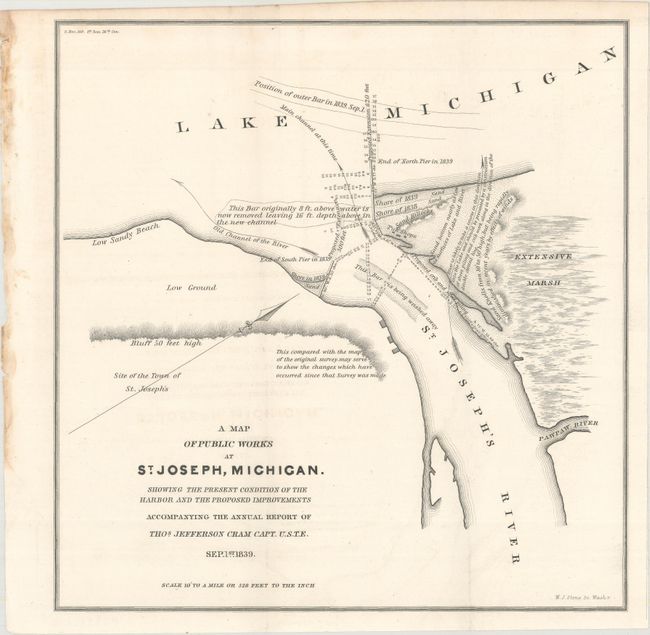
D. A Map of Public Works at St. Joseph, Michigan... (10.5 x 10.8"). This small map depicts where the St. Joseph River meets Lake Michigan. There are numerous notes detailing the changes to the shore and sand bars. The progress of the harbor is shown, as are proposed improvements. The site of the town of St. Joseph is identified.
References: Claussen & Friis #332-35.
Condition: A
The maps are clean and bright with just a hint of offsetting. They are dog-eared at bottom left where the maps folded into the report.