Subject: Washington, D.C.
Period: 1880-81 (published)
Publication: Annual Report of the Commissioners of the District of Columbia
Color: Printed Color
Size:
30.5 x 21.3 inches
77.5 x 54.1 cm
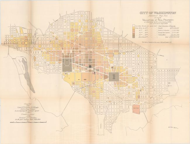
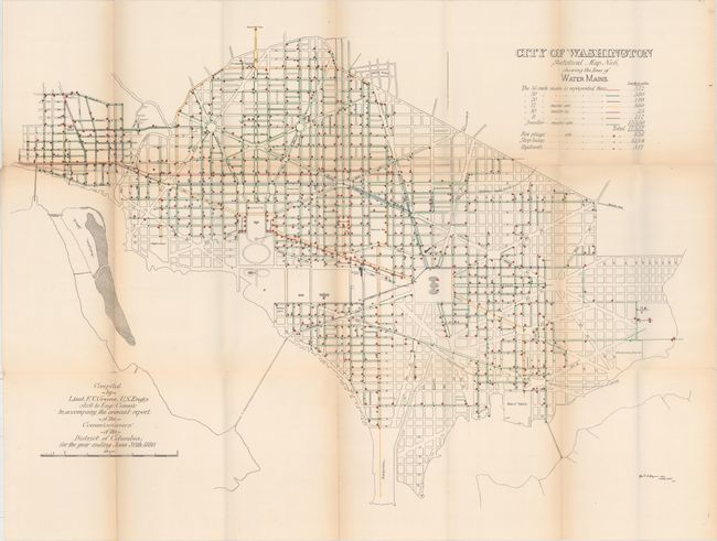
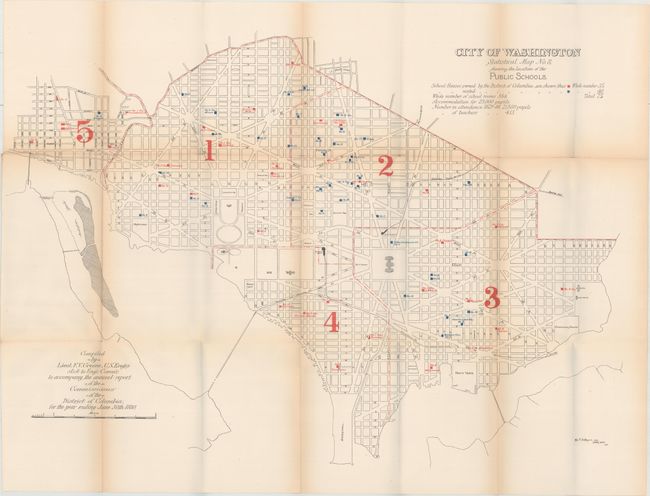
This is the first edition and the complete set of the twelve original Greene maps published to show the large-scale improvements in the infrastructure of the city. These maps were compiled by Lieut. F.V. Greene to accompany the annual report of the commissioners of the District of Columbia, for the year ending June 30th 1880. Each map carries the title "Statistical Map No.__," is drawn on an identical scale and shows the street pattern of Washington. Each has a specialized focus, e.g. valuation of real estate, street grade, varieties of street pavements, shade trees, sewers, water supply and distribution, street lamps, public schools, police and fire department stations, street railways, scheduled street sweeping, and underground cables. Very interesting details emerge from the maps, e.g., there were 1266 telegraph poles with 30.5 miles of line and 436 miles of wire; New Jersey Ave. was paved with wood and swept once each month. This important and complete set of twelve matched maps in their first edition provide a remarkable look into the capital's infrastructure in the early 1880's.
Iris Miller illustrates and describes these maps in good detail in Washington in Maps 1606-2000 (pp. 94-99).
References:
Condition: B
On heavy paper with light toning and faint offsetting. Due to the thick paper, there are a number of fold separations along the upper fold, with sheet #3 having several long fold separations that have been closed on verso with archival tape.