Subject: San Francisco, California
Period: 1891 (published)
Publication:
Color: Printed Color
Size:
24.9 x 19.9 inches
63.2 x 50.5 cm
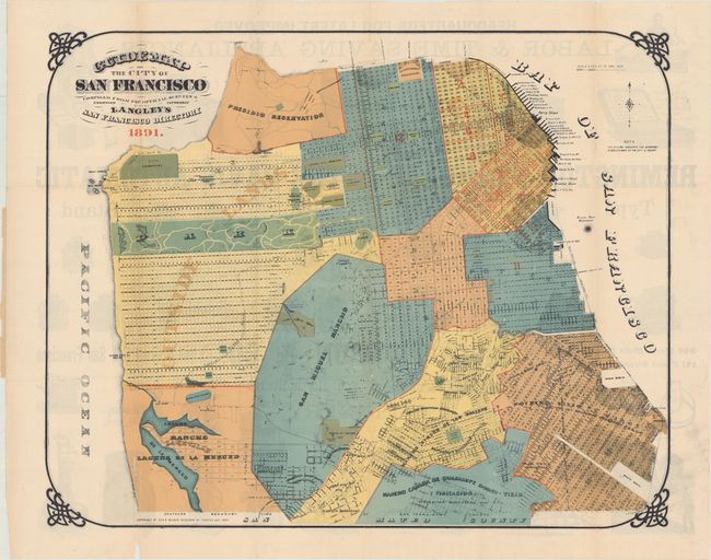
This scarce, early San Francisco directory is complete with folding map by Henry Langley. It shows the city at the end of the 19th century, with much of the street-grid pattern laid out. The large Golden Gate Park in the western portion of the city is simply named "park", and along with several large cemeteries, make up the "Outside Lands." Numerous docks in San Francisco Bay are identified and labeled including Fisherman's Wharf. The verso of the map contains an advertisement for G. G. Wickson & Co who sold appliances and farm equipment.
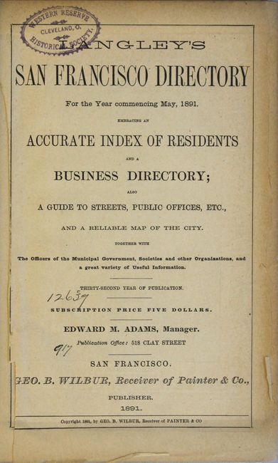
The accompanying large directory includes a resident index, business directory, local government guide, and copious amounts of advertising which altogether provides a fascinating glimpse of the city at the time. 1677 pages with several single-page color advertisements. Published by George B. Wilbur in San Francisco.
References:
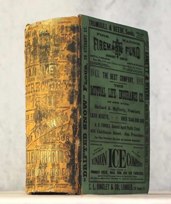
Condition: B
The folding map has a number of fold separations closed on verso with archival tape, and several thin slivers of loss along the left vertical fold at bottom. Text is very good with light toning along sheet edges. The title page and one advertising leaf is loose, with some chips to the left margin of the title page. There is an old library stamp on the title page, the verso of the map, and an old bookplate on the front pastedown. Spine is heavily rubbed, the hinges are starting, and there is some minor soiling on the covers.