Subject: Western United States
Period: 1935-47 (dated)
Publication:
Color:
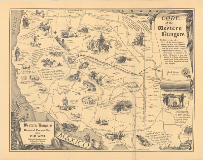
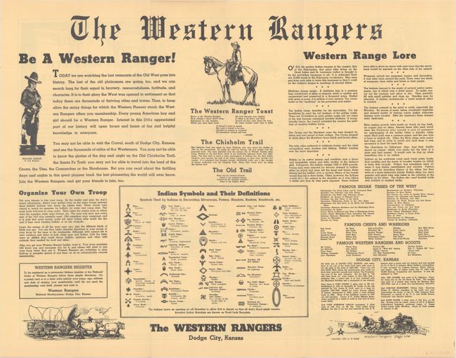
A. Western Rangers Historical Pioneer Map of the Old West, by C.G. Bathe, dated 1935, black & white (21.9 x 17.0"). This map of the western United States is filled with illustrations of key events and landmarks west of the Mississippi River including the Pony Express Route, Custer's Last Stand, and traveling on the Oregon Trail to name a few. A scroll at top right contains the "Code of the Western Rangers" with an unsigned membership pledge. The verso contains text and illustrations describing the Western Rangers and how to organize a troop. This group appears to be a western alternative to the Boy Scouts of America.
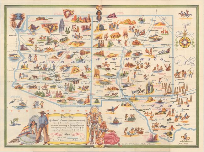
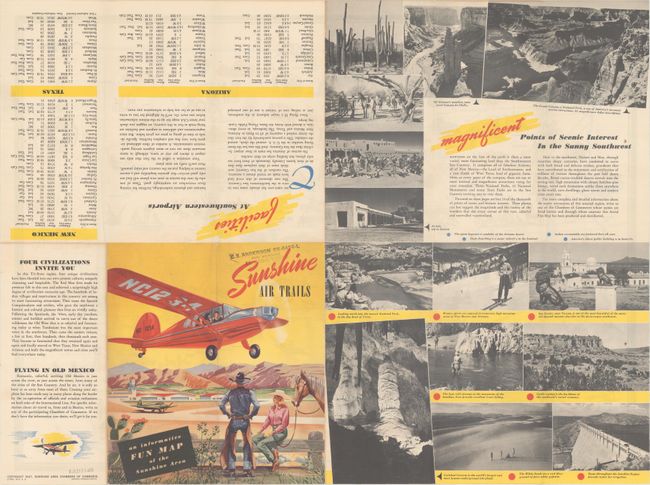
B. This Map of America's Sunshine Area Can Indicate Only a Few of the Numberless Scenic and Historic Attractions..., by B.E. Lewis, dated 1947, printed color (23.1 x 17.0"). A fun pictorial map of the southwest issued by the Sunshine Area Chambers of Commerce. The map covers Arizona, New Mexico, and west Texas and is filled with illustrations for the tourist including fishing, skiing, historic sites, and an unusual number of bikini-clad sunbathers in New Mexico! Air routes, not roads, are drawn on the map owing to an increase in commercial aviation following World War II. The verso contains related text and illustrations. Self folding.
References:
Condition: A+
Fine examples, issued folding.