Subject: Mid-Atlantic United States
Period: 1874 (dated)
Publication:
Color: Black & White
Size:
32.3 x 56.4 inches
82 x 143.3 cm
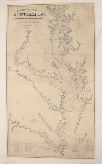
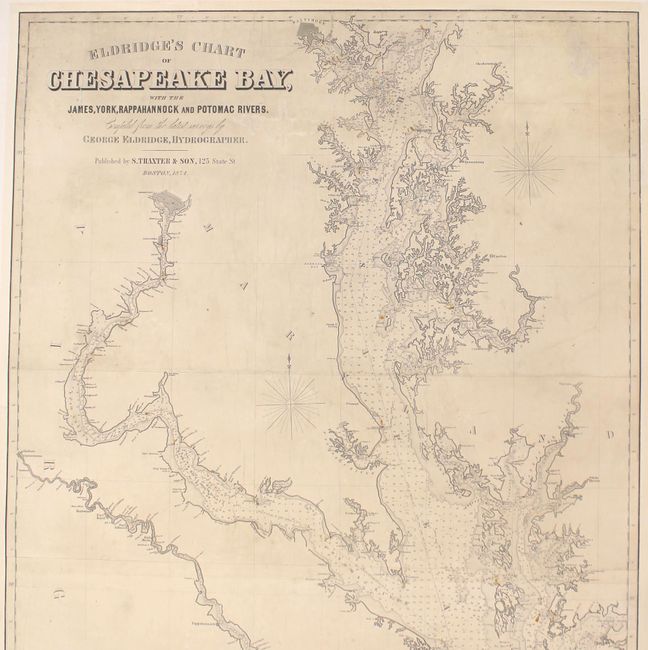
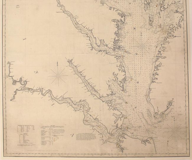
This is the 1874 state of this important chart, first published in 1868. The finely detailed and boldly engraved chart covers the Chesapeake Bay from Norfolk north to include Baltimore, along with tributary rivers to Richmond (James River), Fredericksburg (Rappahannock), and Washington, D.C (Potomac). The legend and tables locate buoys, rocks, shoals, type of bottom, light houses, and more. Dotted lines on the chart give sailors the distance and sailing directions between ports and numerous buoys or other intersections; it is filled with hundreds of soundings. Notations discuss various buoys, their meaning, and how to approach the navigational types as defined in the Act of 1850. Published by S. Thaxter & Son in Boston.
George Eldridge was a former captain of a fishing boat out of Cape Cod who first began producing navigational charts in 1851. Most of the Eldridge charts were based on official U.S. Coastal Surveys and produced specifically for mariners and backed with linen for ease of use and storage. These working sea charts are uncommon on the market today.
References:
Condition: B
A dark impression on a sheet that has been professionally backed with heavy linen to reinforce and repair several small tears at top and bottom, as well as one small tear adjacent to the title. There are a few abrasions at top, some cracking in the middle third of the map, and light soiling. The lighthouses have been hand colored in yellow and red, as published.