Subject: World
Period: 1705 (circa)
Publication: Atlas Historique...
Color: Hand Color
Size:
26.3 x 18.5 inches
66.8 x 47 cm
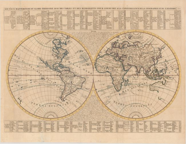
This bold world map from Chatelain’s monumental, seven-volume atlas combines a wealth of information and geographical observations. The two hemispheres are divided into a grid with a corresponding key to the tables surrounding the map, which identifies the locations of principal cities, mountains, rivers, lakes, islands, and other geographical features. The routes of prominent explorers are traced with the dates of their voyages. Australia and New Guinea are joined into one large landmass with only the southern tip of Tasmania outlined.
North America is still vastly unexplored with an uncharted western coastline. This map shows California as a peninsula, in contrast to Chatelain’s renowned Carte Tres Curieuse from the same atlas that depicts it as an island. The Atlas Historique was published between 1705 and 1720 when the question of California’s insularity was hotly contested among leading cartographers. It was common practice for publishers to present both versions of the controversy.
References:
Condition: B+
Issued folding, now pressed, on watermarked paper with a few short fold separations that have been professionally repaired. A fine impression with minor soiling, a very faint damp stain at bottom left, and a couple of minor abrasions at far left.