Subject: Eastern United States
Period: 1812 (dated)
Publication: Myers's Geography
Color: Black & White
Size:
9.3 x 7.5 inches
23.6 x 19.1 cm
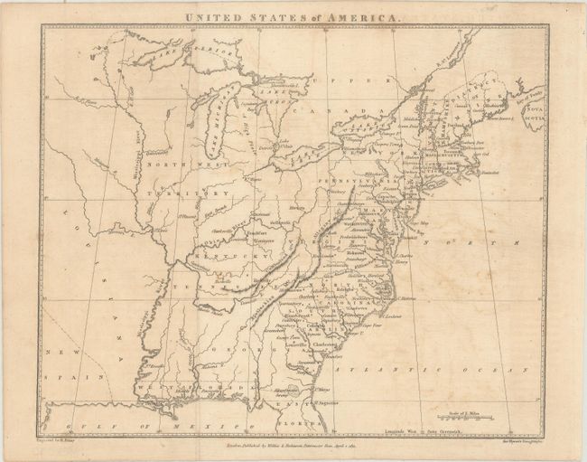
This handsome early map of the United States was published right before Louisiana became a state. As it appears here, Louisiana is a large territory to the west of the Mississippi with no place names. New Spain is located at the far southwestern corner of the map. Florida is still divided into eastern and western sections. The map identifies 16 states, but Ohio is curiously not named. The Northwest Territory and District of Maine are shown as well. Engraved by R. Penny. Published in London by Wilkie & Robinson.
References:
Condition: B+
Issued folding on a watermarked sheet with light offsetting.