Subject: North America
Period: 1794 (circa)
Publication:
Color: Hand Color
Size:
9 x 8.7 inches
22.9 x 22.1 cm
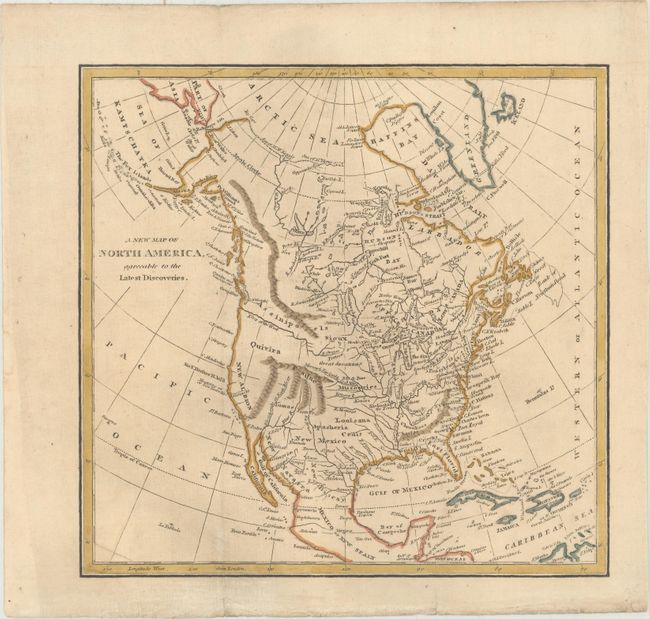
This small map of North America shows the young United States confined to east of the Mississippi River. Florida is divided into East and West Florida, and a prominent River of the West flows into the Pacific. The west coast is labeled New Albion with a few place names along the coast including Sir F. Drake's H. 1578. The interior is largely blank with the exception of some limited topography and the river systems including a note that states that the "Missouri Navigable 1300 Miles."
References:
Condition: B+
Issued folding, now flattened on paper with an "1811" watermark. There is light toning and soiling and a few minute worm holes only visible when held to light.