Catalog Archive
Auction 164, Lot 783

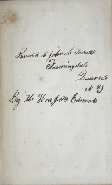
Presentation Example from GLO Commissioner Edmunds

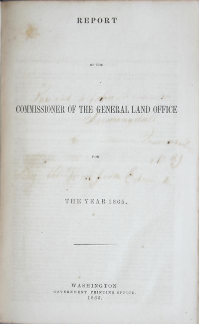
"Report of the Commissioner of the General Land Office for the Year 1865", General Land Office

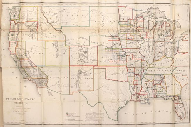
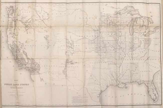
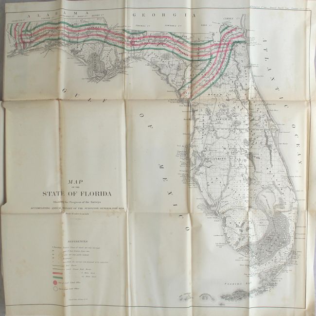
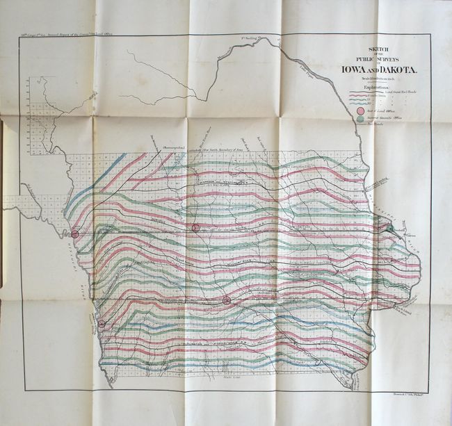
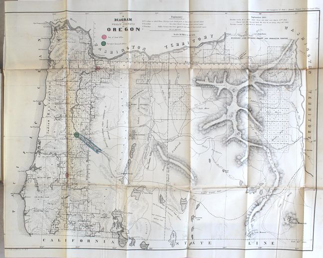
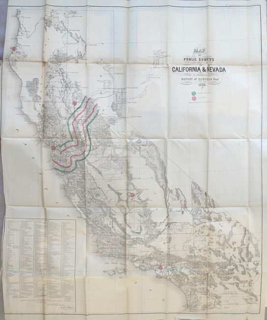
Subject: Exploration & Surveys

Period: 1865 (published)

Publication:

Color: Hand Color

Size:
5.8 x 9.2 inches
14.7 x 23.4 cm
Download High Resolution Image
(or just click on image to launch the Zoom viewer)

This scarce annual report contains 16 folding maps, including 2 of the United States (identical, but one is colored) and 14 hand-colored state survey maps. This example is unusual, however, as text on page 44 indicates that "The diagrams accompanying the annual report of the surveyors general are omitted, and the connected map of the public land States and Territories, brought up to current date therefrom, is bound with this report in lieu of them." It is likely that this was a presentation copy with all of the maps bound in as there is a dedication on the front free end paper from GLO Commissioner Edmunds.

Cartographically, the two examples of Map of the Public Land States and Territories (44.6 x 28.3") cover most of the United States except for the Eastern seaboard because the original 13 states and the state of Texas were exempt from coverage by the General Land Office. The state of the surveys in the remaining states and territories are noted in considerable detail. Wyoming is still attached to Dakota Territory, and the southern tip of Nevada is still attached to Arizona. A small portion of Dakota has been surveyed for settlers but little has been done in Arizona, Nevada, Idaho or Montana. The 14 state survey maps include: Arkansas, Alabama, Florida, Iowa/Dakota Territory, Kansas/Nebraska, Louisiana, Missouri, Mississippi, Minnesota, Michigan, Illinois, Wisconsin, Oregon, and California/Nevada. Each is colored to show the numerous land grants given to the railroads along with 6, 15, and 20 mile limits making many of these states look like they were owned by the railroads. The map of Iowa (see images) is particularly eye-opening. Railroad grants would later become a major topic of debate in the 1884 presidential election between Grover Cleveland (Democrat) and former Speaker of the House, James G. Blaine (Republican) as illustrated by this 1884 campaign poster by Democrats claiming a giveaway of public lands to special interests.

168 pages, hardbound in brown cloth with gilt title on spine.

References:

Condition: B

The maps are in good to very good condition with the typical light scattered foxing, occasional binding tears, and several binder's cuts that go to just inside the left neatline. The maps of Minnesota and Wisconsin have numerous separations along the left vertical fold resulting in some small image loss. Report text is clean and tight with manuscript notations on front free endpaper. Spine is lightly sunned and the edges are bumped.

Estimate: $600 - $750

Unsold

Closed on 9/13/2017

Archived