Subject: Eastern United States
Period: 1793 (dated)
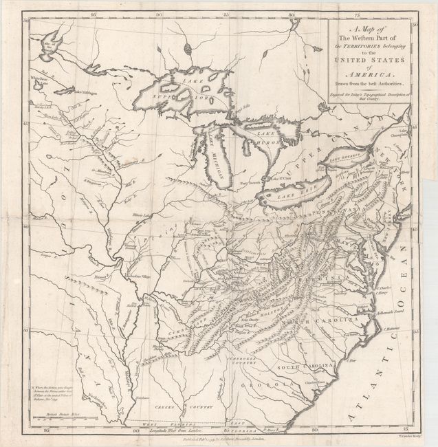
Publication: A Topographical Description of the Western Territory of North America
Color: Black & White
Size:
13.1 x 13.9 inches
33.3 x 35.3 cm
Extremely scarce and very interesting map covering the region from the Great Lakes through Georgia and from the Mid-Atlantic past the Mississippi River. The map shows early roads, settlements, forts, Indian villages with particular emphasis on the western frontiers in Kentucky and Ohio. The battle sites and raids against the United Tribes in 1791 are depicted. Gilbert Imlay, an army officer during the Revolutionary War, emigrated to Kentucky where he worked as a deputy surveyor under George May, at Louisville. Subsequently he went to Europe where he wrote of his experiences on the then-frontier. His book, published by J. Debrett, was illustrated with this and three other great early maps, all of which are scarce.
References:
Condition: B
Issued folding with light soiling, a number of extraneous creases, and professional repairs to some small separations and tiny tears along the folds. There is a binding trim at bottom right and an adjacent 4.5" binding tear that has been professionally repaired.