Subject: Florida
Period: 1822 (published)
Publication: A Complete Historical, Chronological, and Geographical American Atlas...
Color: Hand Color
Size:
9.7 x 11.6 inches
24.6 x 29.5 cm
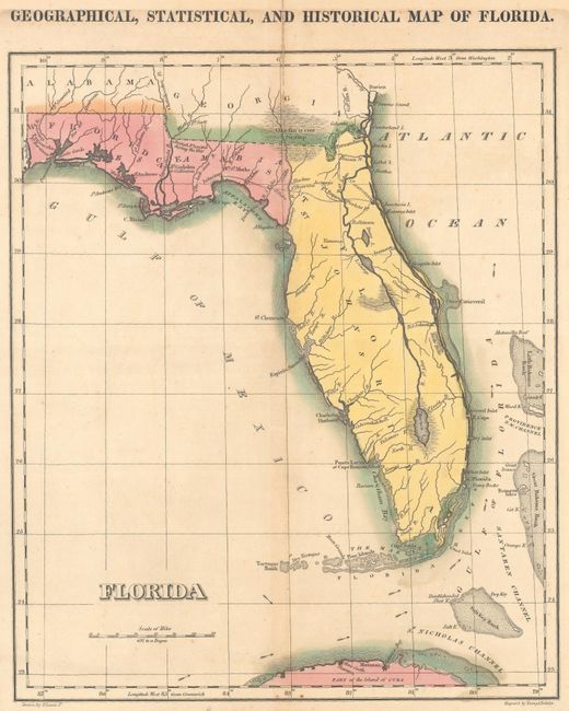
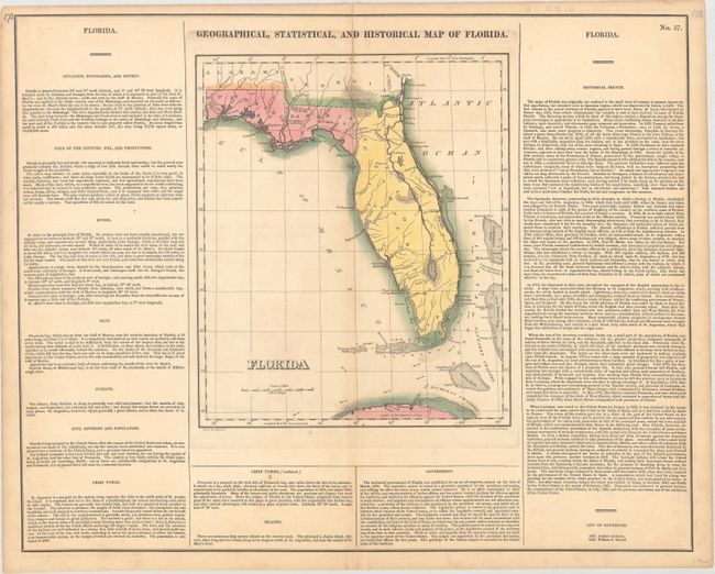
Published around the time that the Florida Territory was officially established as a possession of the United States, this fascinating map shows the territory in nice detail. Most of the settlements, including St. Augustine, are located in the northern part of the territory, while the southern portion of the peninsula, under Seminole control, is bereft of European presence. A single road connects St. Augustine to other settlements in its vicinity, and numerous forts are identified. The territory's many waterways are delineated, with some swampland depicted. The Florida Keys are called the Martyrs, a name generated by Juan Ponce de Leon in 1513, when he charted the islands. Parts of Georgia, Alabama, and Cuba are visible along with numerous smaller islands and currents off the coast. The map is on a full folio sheet (20.7 x 16.6") with English text that details the territory's geography, population (less than 10,000), major towns, government, history, and more. Andrew Jackson and William P. Duvall are listed as the territory's first two governors. Drawn by Fielding Lucas, Jr. and engraved by Young & Delleker.
References: Phillips (Maps) p. 282.
Condition: B+
Original color with a centerfold separation at top that extends 2.25" into the image that has been closed on verso with hinge tape. There is light toning and just a few spots of foxing.