Subject: Southern Africa
Period: 1666 (circa)
Publication: De Zee-Atlas, Ofte Water-Weereld
Color: Hand Color
Size:
20.7 x 11.7 inches
52.6 x 29.7 cm
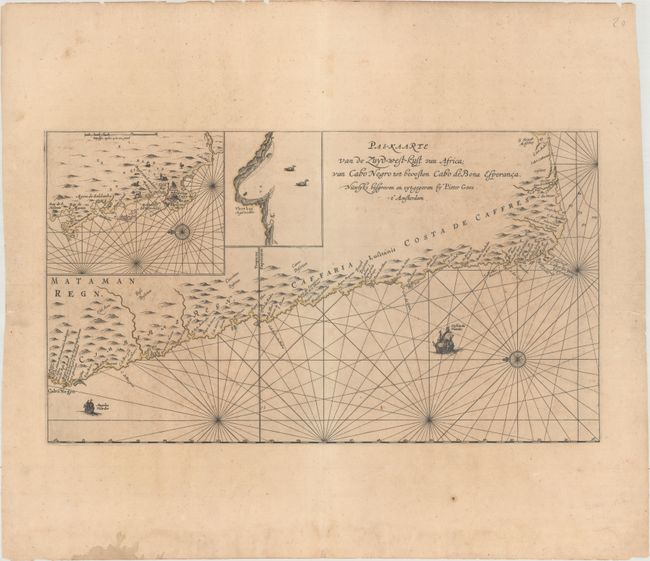
This scarce, elegantly engraved sea chart of the South African coast extends from Cape Negro to the Cape of Good Hope. A large inset provides an overview of the Cape of Good Hope including Table Mount, and a smaller inset illustrates Vlees Bay. A compass rose orients the map with north to the left, and a pair of Dutch and English ships sail the seas. The map appears to be based on a very rare chart attributed to Jodocus Hondius, which described the European holdings in South Africa in 1652 when Van Riebeeck landed in Table Bay. Pieter Goos' marine charts were highly esteemed in the seventeenth century and the Zee-Atlas was often published with Blaeu's Atlas Maior, the most lavish and expensive cartographic publication of the period.
References: Norwich #243.
Condition: B
Faint, original outline color on a toned sheet with wide margins, minor scattered foxing, light offsetting, and two small worm holes in the bottom corners of the image.