Subject: Southern Africa
Period: 1661 (circa)
Publication:
Color: Hand Color
Size:
21.5 x 16.9 inches
54.6 x 42.9 cm
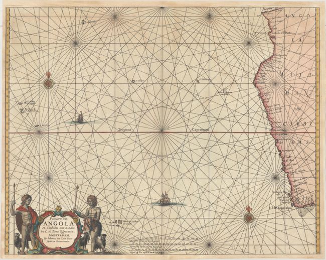
This rare sea chart of the western coast of Southern Africa extends from the Cape of Good Hope to the Congo River, here called the R. Zaire. The coastline is filled with place names, including C. Negro at today's Cape Fria. The chart extends west to include several islands in the Atlantic, including Ascension Island, the Trindade and Martin Vaz archipelago near the coast of Brazil, and two islands named St. Helena, an error commonly found on maps of this time period. The map is adorned with compass roses, ships, and a strapwork title cartouche flanked by two native African goat herders.
References:
Condition: B+
A nice impression with light toning, minor soiling, and a small pencil notation at bottom right. The top, right and bottom margins have been extended to accommodate framing, with a small amount of the neatline and rhumb lines at top center skillfully replaced in facsimile.