Subject: Northern England
Period: 1648 (circa)
Publication: Toonneel des Aerdrycks ost Nieuwe Atlas...
Color: Hand Color
Size:
19.6 x 15 inches
49.8 x 38.1 cm
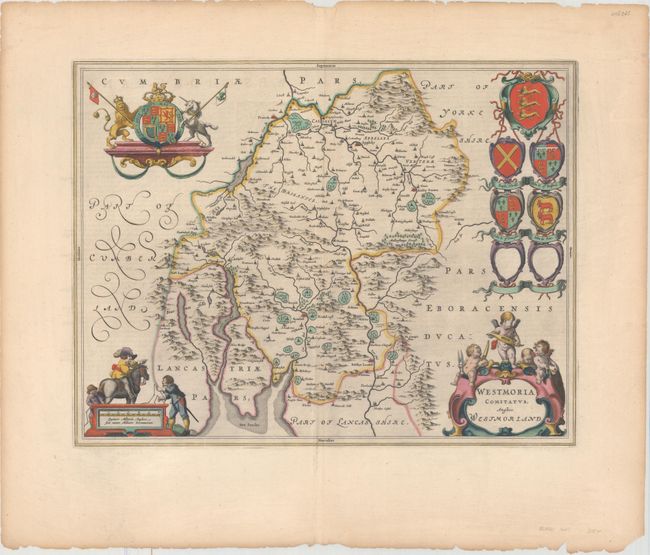
This attractive map of Westmorland is based on John Speed's prior map. It is filled with place names and topographical detail, including scores of tiny, fenced compounds shown across the map with names like Brigster Park, Colnhead Park, Crosbye, and Midleton. Windermere is called Wynandermere, near the Wynander Mere flud (now called Windermere Lake). The map is highly adorned with a royal coat of arms, a scale of miles surrounded by surveyors, a title cartouche topped with putti and six coats of arms, with two being left blank. Dutch text on verso.
References: Van der Krogt (Vol. II) #5380:2.
Condition: A
A nice impression with full original color on a watermarked sheet with light printer's ink residue and minor show-through of text on verso. There are a number of short edge tears and light toning confined to the blank margins.