Subject: French Guiana
Period: 1700 (circa)
Publication:
Color: Black & White
Size:
22.8 x 20.1 inches
57.9 x 51.1 cm
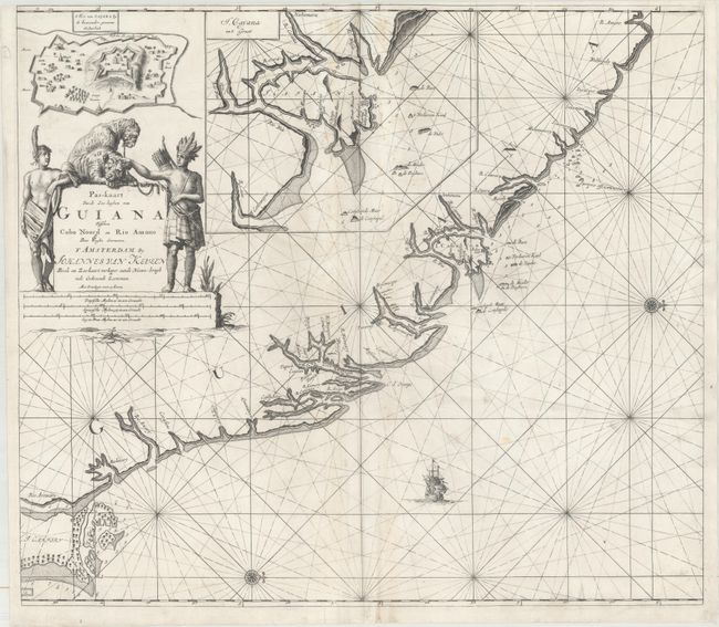
This uncommon sea chart centers on Cayenne, French Guiana and extends north to the Maroni River (border of Suriname/French Guiana) and south to the mouth of the Amazon River. Two insets depict Fort Ceperou and a detailed view of the then-island of Cayenne. The map is filled with soundings, currents, shoals, and anchorages and embellished with rhumb lines, a sailing ship, and compass roses oriented with north to the right. The striking title cartouche features two natives with their tame leopards.
References:
Condition: B+
A dark impression with minor soiling along the centerfold and three short edge tears that just pass the neatline at top that have been repaired on verso with archival material. A small chip in the top right corner of the sheet has been replaced with a portion of the border in facsimile.