Subject: Antigua
Period: 1720 (circa)
Publication:
Color: Hand Color
Size:
22.7 x 16.9 inches
57.7 x 42.9 cm
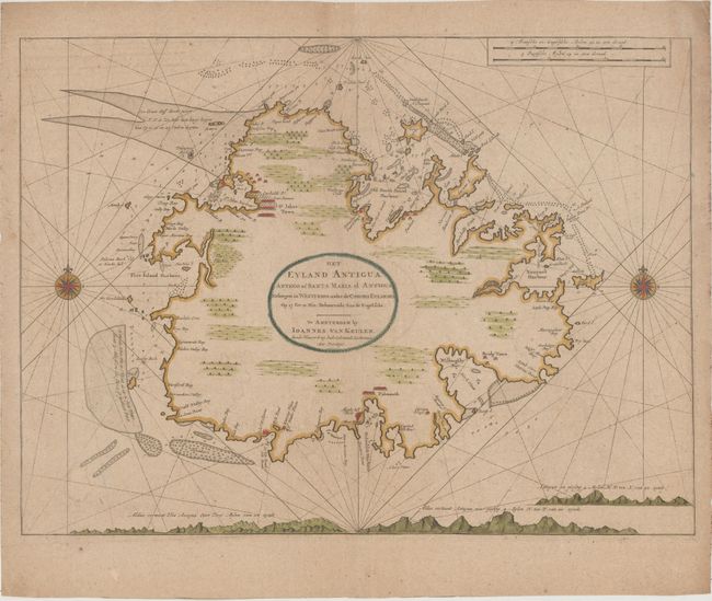
This is a very fine chart of the island of Antigua focusing on the seacoast with soundings, shoals and navigational hazards well delineated. The coastline is noted with place names and the locations of towns, ports, forts and sugar works. The interior is left largely blank and adorned with the large title cartouche. Johannes Van Keulen was the patriarch of perhaps the most prolific of all Dutch map making families. The family firm commenced in 1680 and dominated Dutch sea chart publishing throughout the 18th century until the opening of the Dutch Hydrographic Office in the 19th century.
References: Tooley (MCC-55) #9.
Condition: B+
Lightly toned on paper with a "GWP" watermark, minor offsetting, a stain at bottom left, and several extraneous creases along the centerfold.