Subject: United States & Mexico
Period: 1831 (circa)
Publication: A New General Atlas of the World
Color: Hand Color
Size:
16.1 x 13.2 inches
40.9 x 33.5 cm
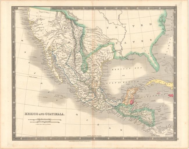
This detailed map of Mexico and Central America extends to include present-day California and Texas. The region north of Texas is simply labeled Desert and is included in the United States. New Mexico extends north into the Rocky Mountains. The rivers Timpanogas and San Buenaventura run straight into the Pacific. Locates many Indian tribes, forts and early settlements. Surrounded by a keyboard-style border.
Henry Teesdale was a prominent London publisher and founding fellow of the Royal Geographical Society. He produced large-scale maps and charts and a number of fine atlases in the early part of the nineteenth century. He employed the most skilled draftsmen and engravers and his maps are renowned for precise detail and fine coloring. His maps are increasingly scarce on the market.
References:
Condition: B+
On watermarked paper with light toning along the centerfold.