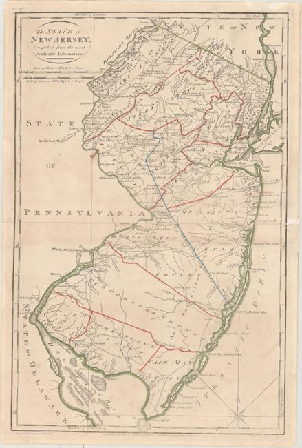
Subject: New Jersey
Period: 1795 (circa)
Publication: American Atlas
Color: Hand Color
Size:
12.2 x 18.5 inches
31 x 47 cm
Handsome topographical map showing counties, the division line of East from West Jersey, towns, mills, courthouses and many roads. Carey's American Atlas was originally issued in 1795 to accompany the American edition of Guthrie's Geography Improved, and it was subsequently issued into the early nineteenth century. This is the first state of the plate without a plate number. Compiled by Samuel Lewis and engraved by W. Barker.
References: Wheat & Brun #414.
Condition: B+
Light soiling with a small stain near Bethlehem and an old manuscript notation south of Sandy Hook. The map has been professionally repaired along the centerfold where it was completely separated. Remnants of hinge tape on verso.