Subject: Florida
Period: 1835-74 (circa)
Publication:
Color: Hand Color
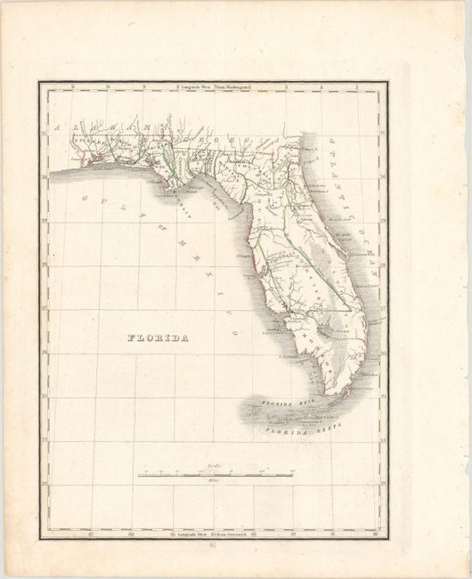
A. Florida, by Thomas Gamaliel Bradford, circa 1835 (7.8 x 10.2"). A beautiful example of this map which details Florida a decade prior to attaining statehood. County configuration is current to 1833 as Hillsborough is not yet shown on the map, and instead a large non-county Indian Reserve occupies the middle of the state. Columbia County now appears (1832) and was created from a portion of Alachua, whose name still stretches across the new county.
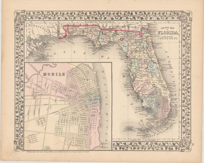
B. County Map of Florida, by Samuel Augustus Mitchell, dated 1874 (13.4 x 10.8"). This map features Mitchell's lovely grapevine border and a large, detailed inset plan of Mobile. There is good detail throughout, and county configuration is current to 1860 as Polk County does not appear. The railroads traverse the northern portion of the state, extending only as far south as Levy County on the Gulf of Mexico. The Everglades and Big Cypress Swamp cover the entire southern portion. Miami is named in the newly formed Dade County.
References:
Condition: A