Subject: California
Period: 1870 (dated)
Publication:
Color: Hand Color
Size:
15.1 x 21.4 inches
38.4 x 54.4 cm
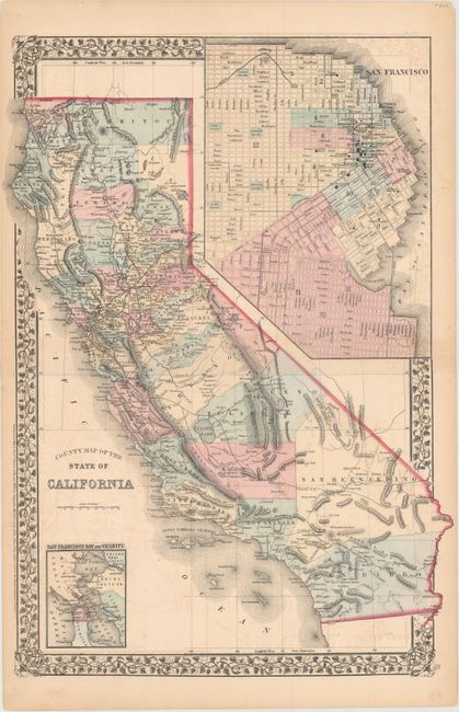
This double-page map of California features a huge (7.8 x 10.8") inset of San Francisco with excellent detail of existing streets and various locales. The map shows the cities, towns, counties, and railroads of the day. The bay appears with little of the reclamation we see today. A smaller inset, San Francisco Bay and Vicinity, extends to show all of San Pablo Bay, Vallejo and part of Mare Island, and portions of the counties of Solano, Marin, Conta Costa, San Mateo, and Alameda. San Bernadino County extends nearly to the Pacific Ocean, only stopped by a sliver of Los Angeles County. No sign of Orange County, as it would be formed five years later. Tulare Lake is shown at its full extent, while there is no sign of the Salton Sea.
References:
Condition: B+
Light offsetting, minor soiling, a short centerfold separation in the right blank margin, and a couple of tiny tears along the edges of the sheet.