Subject: Central United States
Period: 1844-45 (dated)
Publication: Morse's North American Atlas
Color: Hand Color
Size:
14.9 x 12.6 inches
37.8 x 32 cm
A nice set of maps covering the Upper Midwest from Morse's North American Atlas:
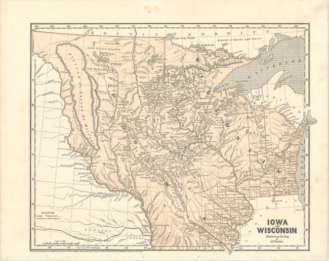
Iowa and Wisconsin Chiefly from the Map of J.N. Nicollet. This is one of the earliest obtainable maps for both Wisconsin and Iowa and the only commercially issued example of Nicollet's important map of the region. The map details Wisconsin and the Upper Plains to the Missouri and Little Missouri Rivers beyond Ft. Mandan to the White Earth River. Iowa fills the area between the Mississippi and Missouri Rivers all the way to the Canadian border. Filled with remarkable detail for the period of the numerous lakes and rivers, particularly between the Mississippi and the Missouri Rivers. Numerous Indian trails and villages and early forts are located. Good detail of the explorations in the region.
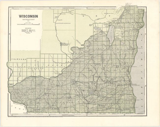
Wisconsin Southern Part. Covers the portion of the territory below the Wisconsin and Fox rivers, where surveying has been completed. The map is filled with lakes and rivers, and identifies several Indian reservations including land of the Oneida, Stockbridge and Brothertown tribes. Numerous lead and copper mines are located near the Mississippi River.
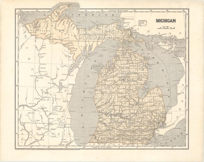
Michigan. Shows the extent of surveying in the state with all but a few counties in the Upper Peninsula completely surveyed. The map depicts canals and railroads, and names county seats.
References:
Condition: A
Clean, bright examples. The map of Iowa and Wisconsin has tiny binding holes confined to the lower blank margin.