Catalog Archive
Auction 162, Lot 182

"A Map of Virginia, North and South Carolina, Georgia, Maryland with Part of New Jersey &c.", Baldwin, Robert

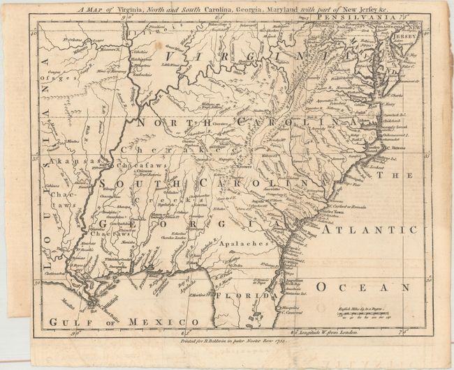
Subject: Colonial Southeast United States

Period: 1755 (dated)

Publication: London Magazine

Color: Black & White

Size:
10.4 x 8.4 inches
26.4 x 21.3 cm
Download High Resolution Image
(or just click on image to launch the Zoom viewer)

This uncommon little map of the Southeast was based upon John Mitchell's Map of the British Colonies. The colonies are shown to extend to the Mississippi River, beyond which is French Louisiana and the domains of the Arkansas, Chactaw and Osage Indians. There is no border shown between South Carolina and Georgia and most of that region is dominated by Indians villages and a lone Eng. Factories in present-day Mississippi. Many early forts are located including Ft. Mobile, Ft. Rosalie, Ft. Francis, Ft. Chartres, Ft. Orleans on the Missouri, and numerous unnamed French and English forts.

References: Jolly #LOND-95; Cumming (SE) #294; Sellers & Van Ee #1381.

Condition: B+

Issued folding with faint offsetting and one small spot.

Estimate: $550 - $700

Sold for: $400

Closed on 4/26/2017

Archived