Catalog Archive
Auction 162, Lot 169

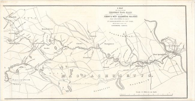
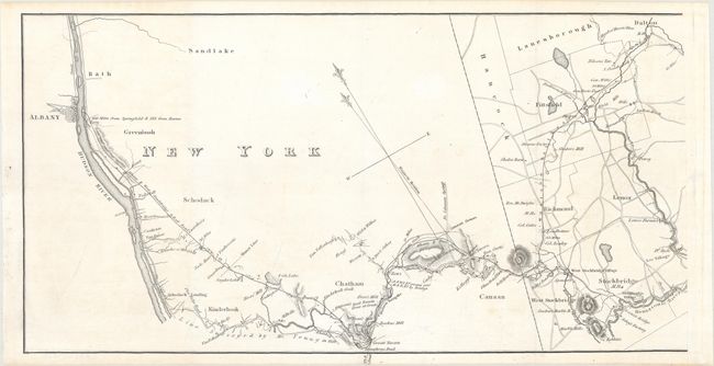
"[On 2 Sheets] A Map of Part of the Western Rail Road and of the Albany & West Stockbridge Rail-Road from Springfield to Albany in Massachusetts and New York, with the Routes of Some of the Experimental Surveys",

Subject: New England - United States

Period: 1841 (circa)

Publication:

Color: Black & White

Size:
15.1 x 7.8 inches
38.4 x 19.8 cm
Download High Resolution Image
(or just click on image to launch the Zoom viewer)

This map was published in the Monthly Chronicle and depicts two railroads from Springfield, Massachusetts to Albany, New York. It shows additional survey work to the south of the existing lines including a "Line Surveyed by Mr. Young in 1826" and a "Survey of the Southern Route." The map identifies individual property owners and locates numerous wagon roads, watershed, and topography. Drawn on a scale of 2.5 miles per inch.

References: Phillips (Maps) p. 512.

Condition: A

Clean and bright with faint offsetting. Issued folding.

Estimate: $180 - $220

Unsold

Closed on 4/26/2017

Archived