Subject: Exploration & Surveys, Texas
Period: 1849 (published)
Publication: Sen. Ex. Doc. 5, 31st Congress, 1st Session
Color: Black & White
Size:
5.5 x 8.7 inches
14 x 22.1 cm
The Office of Coast Survey is the oldest U.S. scientific organization, dating from 1807 when Congress directed that a "survey of the coast" be carried out. By 1836, it was called the U.S. Coast Survey and in 1878, the name was changed to the U.S. Coast and Geodetic Survey. Today the Office of Coast Survey is a division of the National Oceanic and Atmospheric Administration NOAA.
The survey teams, composed of civilians as well as Army and Naval officers, charted the nation's waterways and produced a wide array of reports, survey charts, hydrographic studies of tides and currents, astronomical studies and observations, and coastal pilots. These charts are an important record of the changing nature of the nation's coastlines. In additional to coastal charts, the U.S. Coast and Geodetic Survey produced land sketches, Civil War battle maps, and the early aeronautical charts.
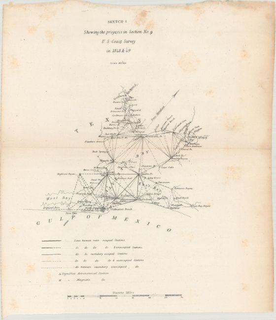
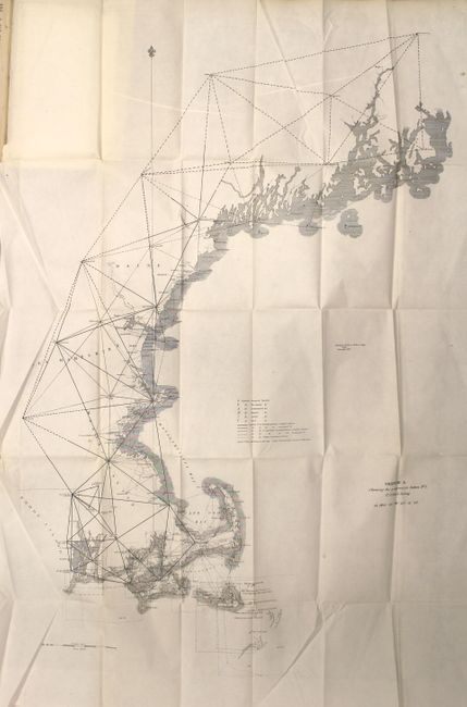
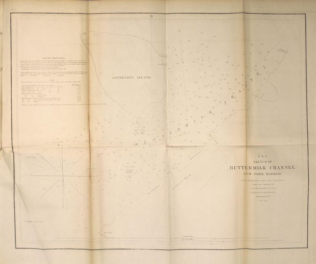
This annual report includes 16 maps and plates and offers some of the earliest maps produced by the U.S. Coast Survey. The maps included are primarily along the eastern seaboard including New York Harbor, Chesapeake Bay and Albemarle Sound to name a few. It also features a very early survey at Galveston Bay entitled "Sketch 1 Showing the Progress in Section No. 9." The surveying work along the Texas coast began at Galveston Bay with triangulations laid out in every direction and key points determined from Galveston Bay to the mouth of the Brazos River. Produced under the direction of A.D. Bache. Disbound, 98 pages with 16 foldout maps and plates.
References: cf. Martin & Martin, p. 147.
Condition: B
The maps are overall good to very good with faint toning along the folds and occasional spots of foxing. Two of the maps (Hatteras Inlet and the Florida Keys) have cleanly severed in half with no paper loss. Two other maps are loose, including Galveston Bay. Report text is very good.