Subject: Colonial North America
Period: 1780 (circa)
Publication: Middleton's Complete System of Geography
Color: Black & White
Size:
17.2 x 10.4 inches
43.7 x 26.4 cm
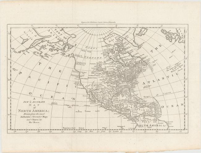
This map of North America is particularly interesting for its depiction of the Pacific Northwest, which is labeled Parts Unknown. Alaska is shown as the small island of Alaschka in the Northern Archipelago. The discoveries of Bering and Tschirikow (1741), Juan de Fuca (1592), and Martin d'Aguilar (1603) are noted along the Pacific coastline of North America. The mythical West Sea, north of New Albion, is shown as an open ended Strait of Juan De Fuca and is not delineated in the interior. The British colonies are shown with boundaries extending to the Mississippi River. Louisiana is wedged between the Mississippi and New Mexico. East and West Florida are named. Indian tribes are noted throughout. In the Pacific the Hawaii Islands have yet to be discovered and a partial island is "Land seen by Mendana."
References: McCorkle (18th C. Geography) #280-13.
Condition: A
A nice impression issued folding.