Subject: Holy Land
Period: 1648 (dated)
Publication: A Pisgah-Sight of Palestine...
Color: Hand Color
Size:
13.1 x 11 inches
33.3 x 27.9 cm
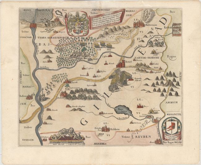
This delightfully illustrated map is from what R.V. Tooley described as "the most quaint and decorative series of maps." The map covers the land of Gilead, east of the Jordan River and southeast of the Sea of Galilee where the children of Gad settled. The map is filled with pictorial illustrations and is embellished with an elaborate coat of arms and dedication to Sir Hugo Wyndham, the shield and flag of the Tribe of Gad and a decorative distance scale.
Thomas Fuller (1608-1661) was a respected English clergyman who wrote several books on the history and geography of the Holy Land. His A Pisgah-Sight of Palestine, published in 1650, was a geographical description of the Holy Land with special reference to biblical history. Fuller financed the book by dividing it into sections and finding sponsors for each one. To acknowledge the patrons, all maps contained decorative cartouches with the sponsor's coat of arms and a dedication to him.
References: Laor #281; Nebenzahl (HL) p.128-131, #4; Shirley (BL Atlases) G.FULL-1a #3.
Condition: B+
Nice impression and color on watermarked paper with light soiling along centerfold at top and a number of worm tracks in the blank margins that have been professionally infilled, only one of which just enters the map at top center.