Subject: Southern Australia
Period: 1913 (dated)
Publication:
Color: Black & White
Size:
79.3 x 41.8 inches
201.4 x 106.2 cm
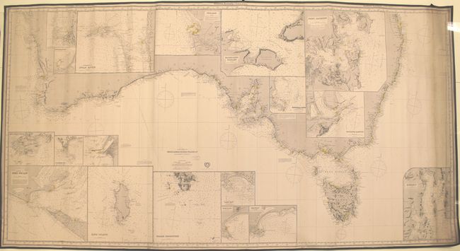
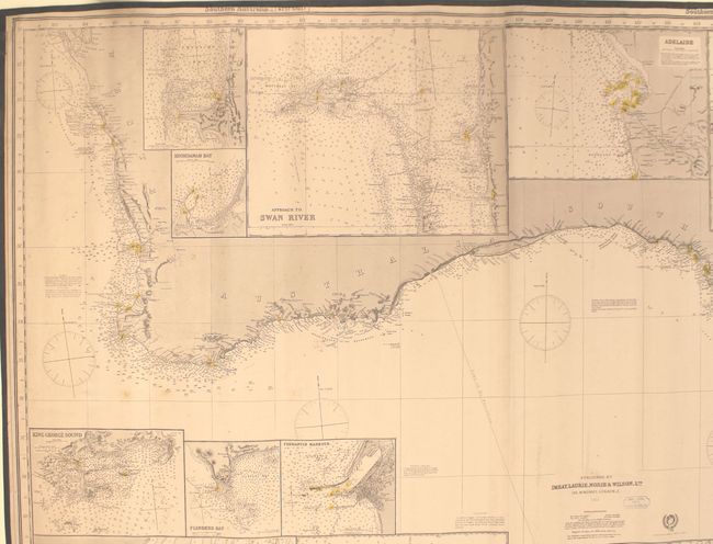
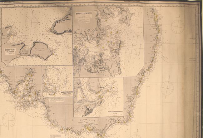
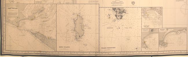
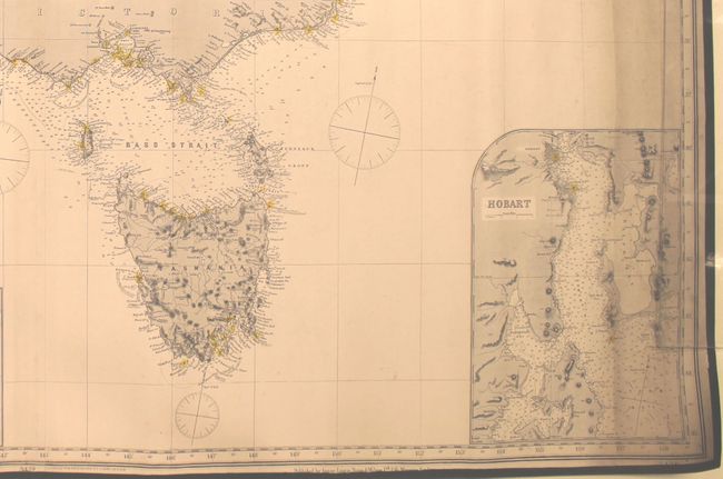
This impressive, large-scale blueback chart consists of three joined sheets and depicts the entire southern coastline of Australia from Perth to Brisbane, including the larger cities of Adelaide, Melbourne and Sydney. It is filled with navigational details including soundings, currents, hazards, trade winds, magnetic variation, and more. Lighthouses are marked in original yellow and red hand coloring with dotted circles to indicate how far light can be seen at sea. Tasmania is well depicted, including some topographical features in the interior. The chart is augmented by 18 insets showing important harbors including Port Phillip, King Island, Wilson Promontory, Approach to Swan River, Adelaide, Port Jackson, and Hobart. Published by the firm of Imray, Laurie, Norie & Wilson at 156 Minories, London. The yellow title label on verso indicates it is "Chart No. 342" at a cost of 12 shillings.
References:
Condition: A
Excellent condition for a map of this size and intended use with only occasional minor spots and soiling primarily along the left and right borders.