Subject: South Pole, Southern South America
Period: 1598 (dated)
Publication:
Color: Black & White
Size:
11.3 x 8.9 inches
28.7 x 22.6 cm
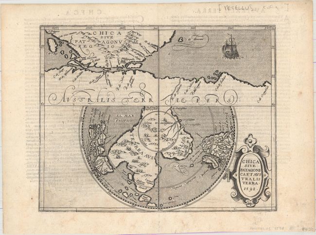
This is the rare and slightly smaller version of the Wytfliet map of the same title. It features Terra Australis, the great southern landmass thought to cover the South Pole and incorporate what would later be discovered to be Australia. The map is divided into two parts. The upper section shows the tip of South America with the Spanish colony of Philippopolis, and the Strait of Magellan that separates it from Terra Australis. The lower map is presented on a polar projection that shows the huge Terra Australis, with promontories reaching towards Africa, Java, and New Guinea. The kingdoms of Maletur, Lucach, and Psittacorum (Land of the Parrots), and the place name Beach are located; nomenclature that continues to appear on subsequent maps of Australia. The sea is stipple engraved and includes an image of Magellan's ship Victoria entering the strait, which is named for him. It is further ornamented with a fine strapwork title cartouche.
References: cf. Tooley (Australia) #1430.
Condition: B+
A fine impression with light offsetting, light show-through of text on verso, minor soiling, and a few tiny tears that have been closed on verso with archival material.