Subject: Southwestern Wales
Period: 1697 (circa)
Publication: Great-Britain's Coasting Pilot
Color: Hand Color
Size:
22.4 x 17.6 inches
56.9 x 44.7 cm
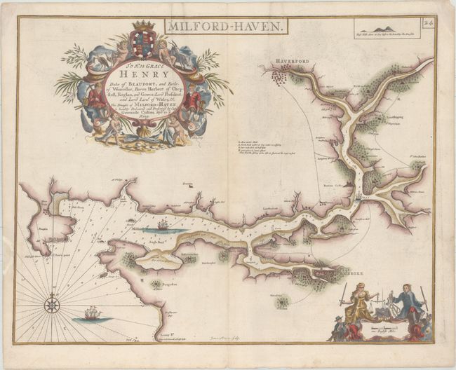
Superb chart of Milford-Haven in southwestern Wales including the towns of Haverford and Pembroke. Finely decorated with a dedication cartouche "To His Grace Henry, Duke of Beaufort..." incorporating cherubs with fish, a goat, water fowl, and miners. The map is further adorned with a beautiful scales of miles cartouche depicting Justice holding scales, a compass rose, and sailing ships. Engraved by James Moxon.
In 1681 Capt. Greenville Collins (fl.1669-1694) an officer in the Royal Navy was appointed by the Admiralty to make a complete survey of the coasts of Great Britain. Prior to this date the charts used by English mariners were copies of Dutch charts that had many inaccuracies. The task of surveying the entire coasts was formidable and took about 7 years, at the end of which only 46 surveys were finally used in an atlas titled "Great Britain's Coasting-Pilot Being a New and Exact Survey of the Sea-Coast of England," which was first published in 1693.
References: Shirley (BL Atlases) M.COLL-1a #15; Verner (MCC-58) #13.
Condition: B+
Heavy paper with two vertical printer's creases, light printer's ink residue, and a chip in left blank margin that has been archivally repaired.