Subject: South Atlantic
Period: 1818 (dated)
Publication:
Color: Hand Color
Size:
36.1 x 24.5 inches
91.7 x 62.2 cm
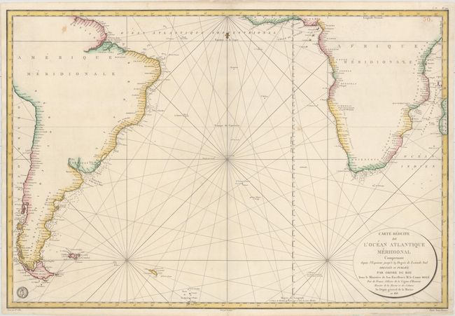
This large-scale sea chart of the southern Atlantic depicts most of South America, including the Pacific coastline up to Pisco, and Southern Africa, including the Indian Ocean coastline up to Juba. There is great detail of islands, coastal ports and harbors, including soundings and the locations of anchorages. The map is adorned with rhumb lines, a fleur-de-lis, the Depot de la Marine emblem and an oval cartouche. Engraved by E. Collin. Prix Trois Francs is stated just outside of the neatline at bottom right.
References:
Condition: B+
A bright example on paper with a "Depot de la Marine" watermark, very light soiling, minor offsetting, and a few tiny worm holes in unengraved areas at top corners that have been professionally infilled. A couple of short edge tears have been closed with archival tape.