Catalog Archive
Auction 159, Lot 287

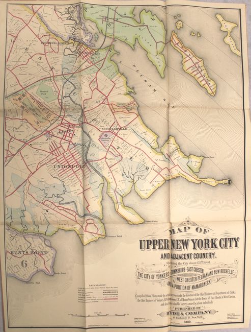
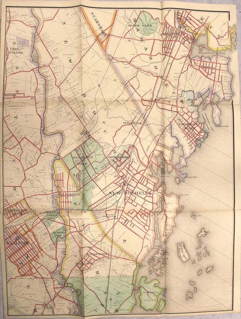
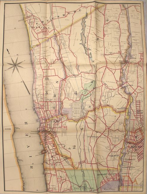
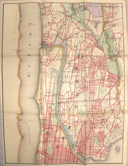
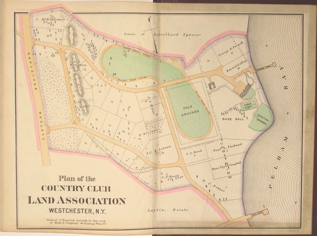
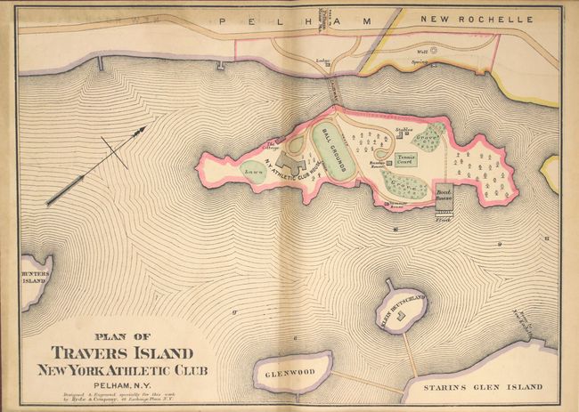
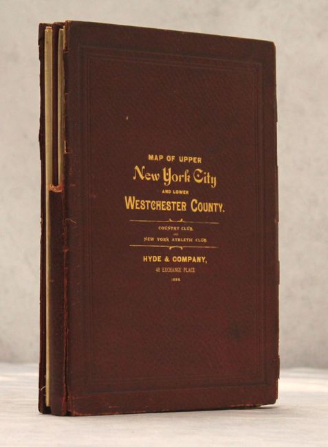
Impressive 4-Sheet Map of Upper New York City and Westchester County

"[On 4 Sheets] Map of Upper New York City and Adjacent Country. Showing the City Above 125th Street. The City of Yonkers and Townships of East Chester, West Chester Pelham and New Rochelle. And a Portion of Mamaroneck",

Subject: New York City, New York

Period: 1889 (published)

Publication:

Color: Hand Color

Size:
8.5 x 11 inches
21.6 x 27.9 cm
Download High Resolution Image
(or just click on image to launch the Zoom viewer)

This large-scale map of upper New York City and southern Westchester County was issued on four sheets (each approximately 24 x 31") that would measure 48 x 62" if joined. Published by Hyde & Company, the map is filled with detail including railroads, cable car lines, streets, parks, cemeteries and even individual property owners. The map's detail is further enhanced with attractive hand coloring, which was quite uncommon in the late 19th century. The map is accompanied by two small maps adhered to the boards entitled Plan of the Country Club Land Association Westchester, N.Y. (13.2 x 10.3") and Plan of Travers Island New York Athletic Club Pelham, N.Y. (13.6 x 10.0"), clearly catering this guide book to a wealthy, high society audience. Backed with original linen and attached to maroon leather boards with gilt title on front cover.

References:

Condition: A

The maps are very clean and brightly colored with just a hint of pleasant light toning. The spine has perished with half the maps attached to the front board and the other half to the back board.

Estimate: $1,500 - $1,800

Sold for: $1,000

Closed on 9/14/2016

Archived