Subject: St. Andrew's Bay & Cedar Keys, Florida
Period: 1851-55 (dated)
Publication:
Color: Hand Color
The Office of Coast Survey is the oldest U.S. scientific organization, dating from 1807 when Congress directed that a "survey of the coast" be carried out. By 1836, it was called the U.S. Coast Survey and in 1878, the name was changed to the U.S. Coast and Geodetic Survey. Today the Office of Coast Survey is a division of the National Oceanic and Atmospheric Administration NOAA.
The survey teams, composed of civilians as well as Army and Naval officers, charted the nation's waterways and produced a wide array of reports, survey charts, hydrographic studies of tides and currents, astronomical studies and observations, and coastal pilots. These charts are an important record of the changing nature of the nation's coastlines. In additional to coastal charts, the U.S. Coast and Geodetic Survey produced land sketches, Civil War battle maps, and the early aeronautical charts.
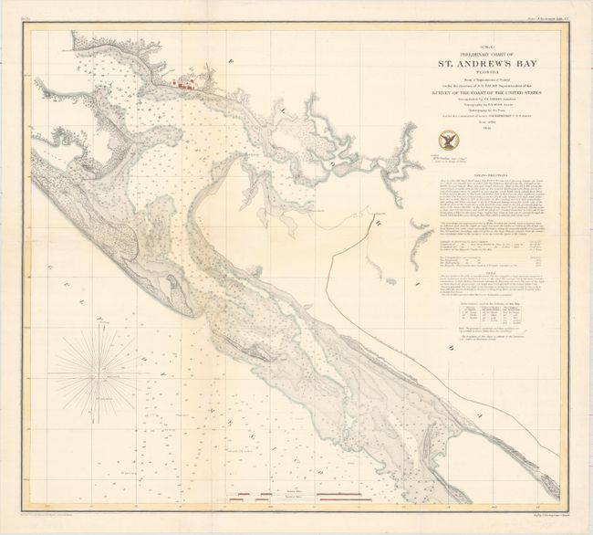
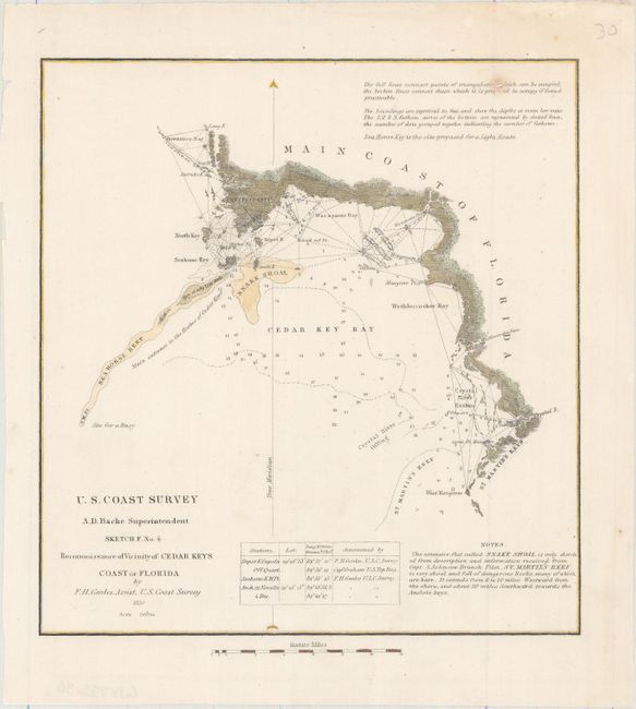
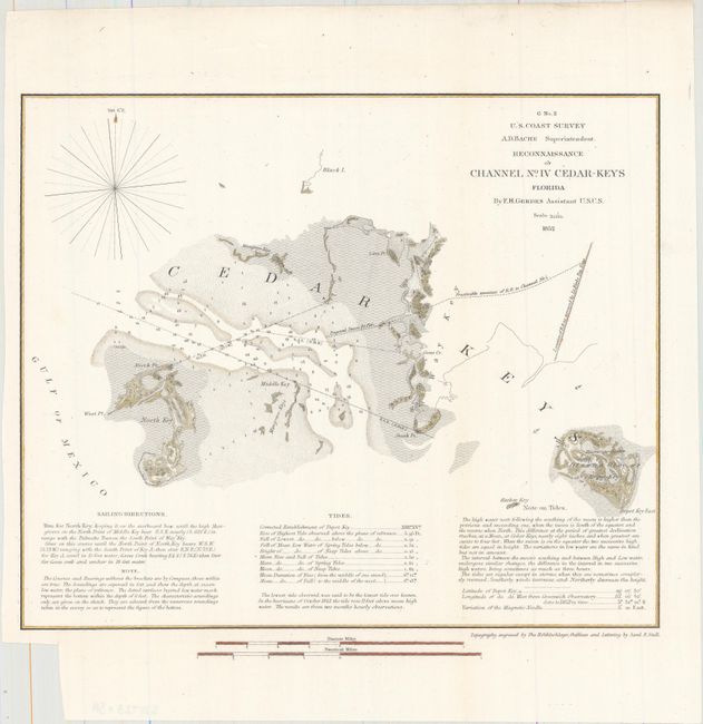
This lot includes three striking charts from the U.S. Coast Survey depicting St. Andrew's Bay and Cedar Keys along the western edge of Florida. The first chart shows St. Andrew's Bay in intricate detail. The second chart covers the stretch of coastline from Cedar Keys to St. Martins Keys, and the third chart zeros in on Cedar Keys. Each includes soundings and other navigational information.
A. (G No. 4) Preliminary Chart of St. Andrew's Bay Florida..., dated 1855 (19.3 x 17.3"). Condition: Issued folding with several short fold separations that have been closed with archival materials on verso and a hint of toning along the left fold. (B+)
B. Sketch F. No. 4 Reconnoissance of Vicinity of Cedar Keys Coast of Florida, dated 1851 (7.8 x 8.3"). Condition: There are a few tiny spots and a tiny hole at top right that has been infilled with archival material. (B+)
C. Reconnaissance of Channel No. IV Cedar-Keys Florida, dated 1852 (10.9 x 9.0"). Condition: Issued folding with a small binding trim in the bottom blank margin. (A)
References:
Condition:
See description above.