Subject: Colonial Mid-Atlantic United States
Period: 1736 (circa)
Publication: Atlas Minor
Color: Hand Color
Size:
7.9 x 10.7 inches
20.1 x 27.2 cm
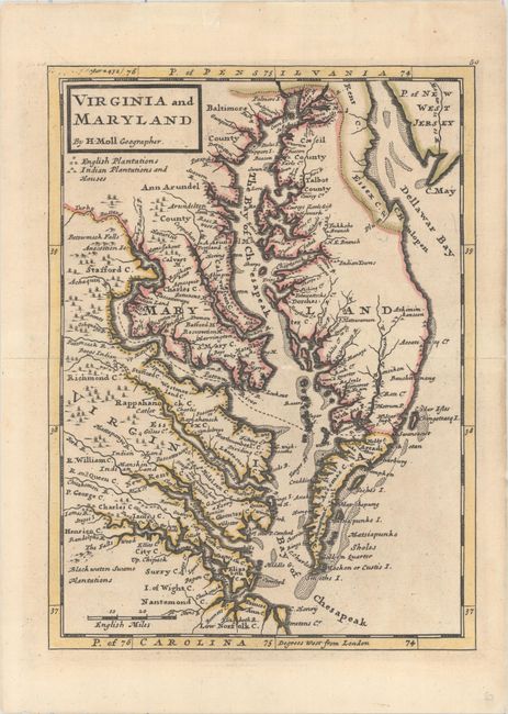
This map of the eastern coast of Virginia, Maryland, and the Chesapeake Bay was based on Augustine Hermann's map of 1673. The map labels counties, towns, water ways, Indian lands, plantations, and provides useful notations such as "the swamp here not passable." A key under the title identifies English plantations and Indian plantations and houses. This map was first published in John Oldmixon's British Empire in America, and then appeared in Moll's Atlas Minor and Thomas Salmon's Modern History: or the Present State of All Nations.
References: Stephenson & McKee #II-16; Wooldridge #86; Shirley (BL Atlases) T.MOLL-9c #54.
Condition: B+
Original outline color on a sheet that has been backed with tissue to reinforce and repair short centerfold separations at left and right that just pass the neatline and a few edge tears confined to the blank margins.