Subject: Western Hemisphere - America
Period: 1790 (circa)
Publication:
Color: Hand Color
Size:
43.8 x 38.3 inches
111.3 x 97.3 cm
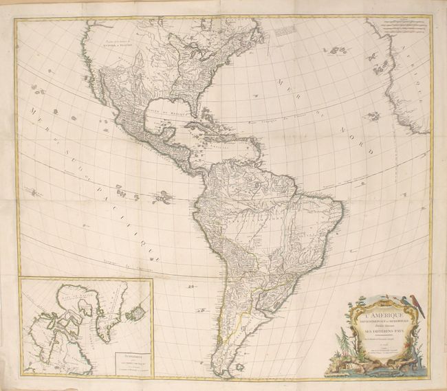
This impressive four-sheet map of North and South America was originally published by Didier Robert de Vaugondy in 1760 and is filled with remarkable detail. In North America, a large "Quivara et Teguaio" occupies the west along with an unnamed river with the note "Entree de Martin d'Aguilar en 1603." This feature is one of the latest depictions of an outlet for the River of the West. In the east, the United States is shown with its new border extending to the Mississippi River. However, "Louisiane" is still shown occupying part of this region - a clear holdover from the first edition that was drawn during the French & Indian War. In South America, the mythical Lake Xarayes is depicted with much of the interior still blank, reflecting the lack of knowledge in the region. The map also features a large inset at bottom of the polar region including Hudson and Baffin bays, with Greenland still attached to a large northern landmass. Decorated by an elaborate title cartouche featuring native flora and fauna. This example, published by Delamarche, is not listed in Pedley.
References: cf. Pedley #20.
Condition: B+
Original outline color in the map with later color in the title cartouche. Light soiling with old fold lines which have numerous small separations and holes that have been professionally repaired on verso, with a minute amount of image replaced in facsimile.