Subject: Geography Books
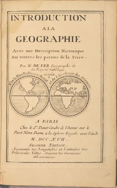
Period: 1717 (published)
Publication:
Color: Black & White
Size:
5 x 7.8 inches
12.7 x 19.8 cm
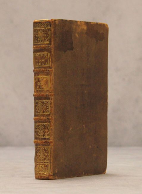
Fine small geography containing maps of the world and continents and a great little title page containing a world map featuring the island of California. Second edition. 6 folding charts, 197 pp. + index. Original calf binding with raised bands and gilt decoration on spine. Original blue ribbon page marker still attached. Contents:
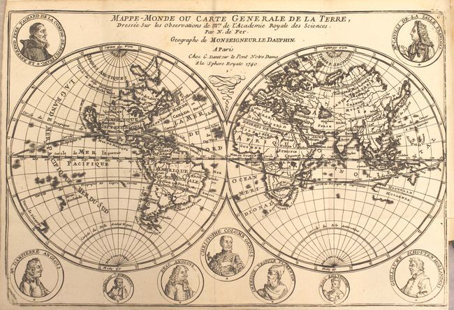
A. Mappe-Monde ou Carte Generale de la Terre… Double-hemisphere world map surrounded by medallion portraits of important explorers. California is depicted as an island, the Great Lakes are not completely formed; nor are Australia, New Zealand and the northeast coast of Asia. The coastline of Korea, Roy.e de Coree, extends far to the east towards the Americas.
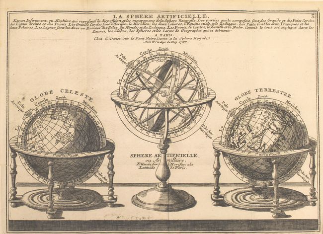
B. La Sphere Artificielle… A nice engraving of a handsome set consisting of a celestial globe, armillary sphere, and a terrestrial globe.
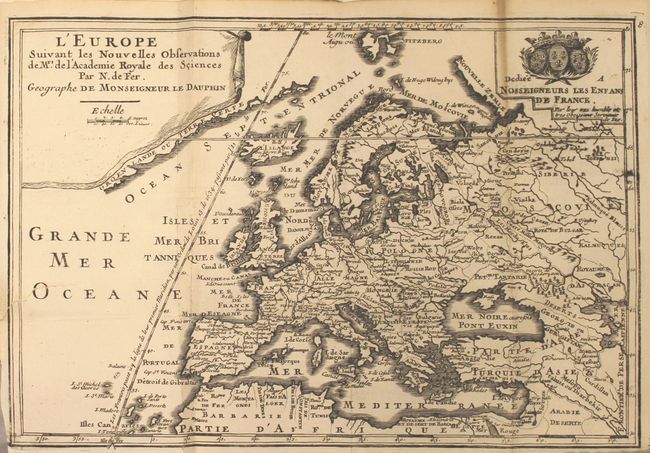
C. L'Europe Suivant les Nouvelles Observations….. A lovely reduced version of De Fer's large map of Europe. Title in drape-style cartouche and dedication cartouche decorates the map. The map extends to include Asia Minor, the Middle East and the northern coastline of Africa.
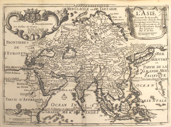
D. L'Asie Suivant les Nouvelles Decouvertes… Fine map of Asia depicting a continuous land bridge extending from northern Korea and eastern Siberia across to the American Northwest, with a notation that explaining that the coastline is based on Portuguese maps, which are "completely different" from French maps. Finely engraved and embellished with three cartouches.
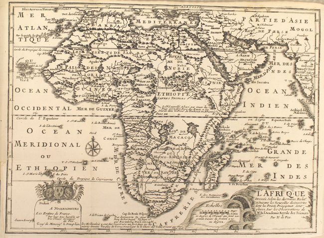
E. L'Afrique Dressee Selon les dernieres… This map of Africa shows the correct source of the Nile but retains the two large twin lakes south of the Equator. Decorative title and dedication cartouches.
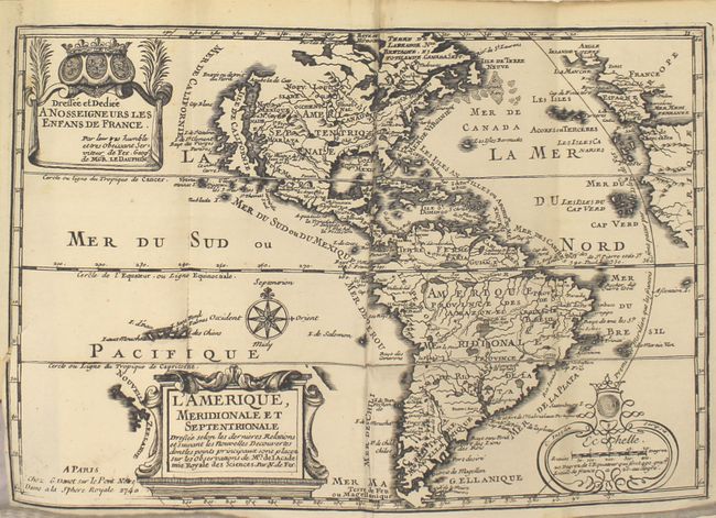
F. L'Amerique, Meridionale et Septentrionale… Featuring the island of California covering the entire west coast north of the Tropic of Cancer with two large imaginary islands offshore. One of the prominent features in northern Mexico is Les Mine de S. Iean et de Ste. Barbe, the legendary Santa Barbara mines of the Chihuahua-Durango region. There are several large spurious lakes on both continents. A partial coastline of New Zealand appears beside the title cartouche. The map is richly decorated with three cartouches and a compass rose. This is the first state.
References: America - McLaughlin #135; Africa - Norwich #64.
Condition: A
The maps all have dark, crisp impressions, occasional misfolds, and very short binding tears (less than 1"). The map of Europe has a 1.5" binding tear, and the world map has a few faint spots. The text is clean and bright with a light damp stain that enters the top gutter of the first 30 pages. The hinges are starting, the front cover has two stains at top, and there is some cracking at the spine. Overall an excellent example with some minor imperfections.