Subject: Southern Africa
Period: 1789 (dated)
Publication:
Color: Black & White
Size:
12.9 x 19.4 inches
32.8 x 49.3 cm
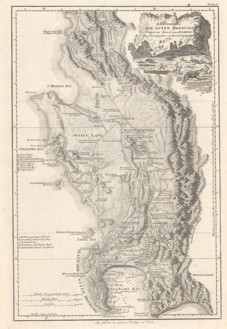
This handsome and detailed map of the southwest tip of Africa is F.A. Schraembl's reissue of Delarochette's 1782 map of the region, originally published by William Faden. It spans from the small and spurious Klipping Eyland od. Klippen Insel just north of St. Helena Bay south to the Cape of Good Hope. Kraals, farms, settlements, salt works, fountains, crossings, roads, and more are located, and there is intricate topographical detail. In the water are plenty of small islands, depth soundings, anchorages, and rocks. There are two keys, one identifying sites of interest inland and the other various islands and bays. The decorative title cartouche at top right features a cliff and African village with settlers on horseback hunting elephants with spears in the foreground.
References: cf. Norwich #225.
Condition: A
A crisp impression with wide margins. There are a few small rust spots and a bit of printer's ink residue.