Subject: Central Africa
Period: 1887 (circa)
Publication: The London Atlas of Universal Geography...
Color: Printed Color
Size:
25.1 x 20.3 inches
63.8 x 51.6 cm
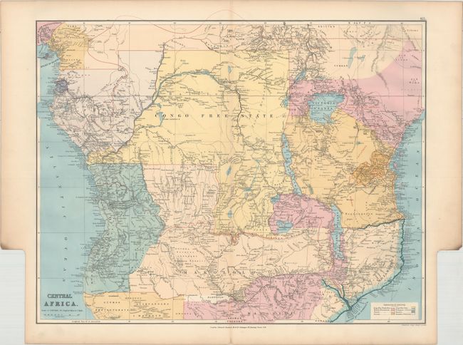
This richly detailed map of Central Africa spans from the Bight of Bonny (Bight of Biafra) south to the mouths of the Zambezi River in Mozambique. It reflects European's growing influence and understanding of inland Africa. Countries, towns, rivers, lakes (with depth measurements), traditional kingdoms, mountains (with elevations), roads, railroads, submarine telegraph lines, and more are shown. A key at bottom right explains the color coding system, and the German and English spheres of influence are specifically identified. The spot where notable Scottish explorer and missionary David Livingstone died is noted in present-day Zambia.
References:
Condition: A
Very minor toning along the centerfold. In the blank margins there is a short centerfold separation at bottom and some light soiling and toning along sheet edges.