Subject: Mauritius, Indian Ocean
Period: 1761 (circa)
Publication:
Color: Black & White
Size:
51.4 x 33.4 inches
130.6 x 84.8 cm
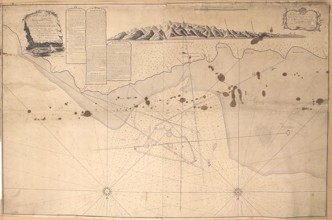
This large-scale chart depicts Port Mathurin on Rodrigues Island, which is located approximately 350 miles to the east of Mauritius. The island was explored by the French in the late 17th century and Port Mathurin was officially established in 1735. Only a few places are noted on the chart including the French Governor's House, a Store House, and a Watering Place. The waters off the island, however, are filled with navigational information including soundings, shoals, anchorages and rhumb lines. Includes an approach view at top.
References:
Condition: C+
The chart has been backed with linen to reinforce and repair several edge tears including a 13" tear at right, a 9" tear at left, and a 5" tear at top. Trimmed to inside the neatline at bottom with border replaced in facsimile. A thin, 6" section of border at top right has been reattached. Staining in the top half of the image.