Subject: Ancient World
Period: 1854 (circa)
Publication: Atlas de Choix, ou Recueil des Meilleures Cartes de Geographie Ancienne et Moderne
Color: Hand Color
Size:
19.5 x 15.1 inches
49.5 x 38.4 cm
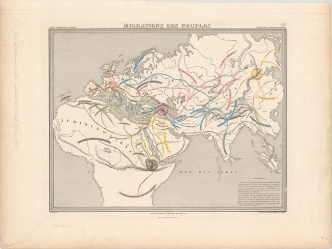
This interesting and unusual map of the Ancient World includes Europe and most of both Africa and Asia. Drawing on the work of contemporary racial pseudoscientists Blumenbach, Linneaus (here misspelled as Lynek, and Cuvier as well as ancient historian Friedrich Chritoph Schlosser, it divides the world's population into three races: the Caucasians, the Mongols, and the Ethiopians. The color-coded map illustrates the distribution of these races across the hemisphere. It locates rivers, mountain ranges, and Babylon. Drawn by E. Soulier. J. Andriveau and J. Goujon, working collectively as Andriveau-Goujon, were among the most prominent cartographic publishers in Paris during the 19th century. They published high quality pocket maps, globes, and atlases and often worked with other prominent French cartographers including Brue and Levasseur.
References:
Condition: A
In the blank margins there is light soiling and toning and some manuscript notations in pencil.