Subject: Holy Land
Period: 1629 (dated)
Publication:
Color: Black & White
Size:
19.6 x 15 inches
49.8 x 38.1 cm
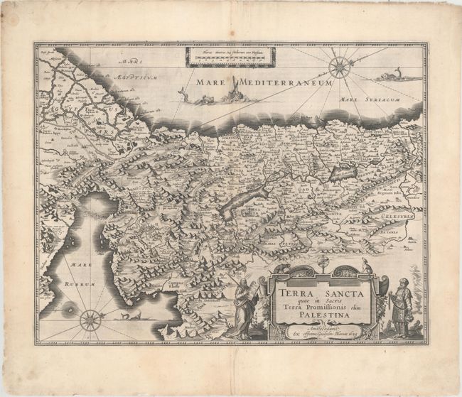
Magnificent map of the Holy Land, viewed as Moses would have seen it from atop Mt. Pisgah in his vision of the Promised Land. The Exodus and the Wandering of the Children of Israel are depicted in the Sinai. Moses and Aaron flank the decorative cartouche, Jonah and the whale are shown in the sea, and the Pharaoh's forces are seen drowning in the Red Sea. The Mare Mortuum or Dead Sea is shown in a distorted shape with Sodom and Gommora burning within it. The map is oriented with west at the top by two lovely compass roses. This map was engraved by Jodocus Hondius and the plate was purchased by Blaeu who issued it under his own name. Latin text on verso, published in 1631.
References: Van der Krogt (Vol. II) #8150:2:2; Laor #106; Nebenzahl (HL) #42.
Condition: B+
A dark impression with several small fold separations closed on verso with archival material with a tiny portion of the bottom border in facsimile. There is light extraneous creasing adjacent to the centerfold and a few small stains. Remnants of hinge tape on verso.