Subject: World
Period: 1851 (circa)
Publication:
Color: Hand Color
Size:
21.9 x 15.2 inches
55.6 x 38.6 cm
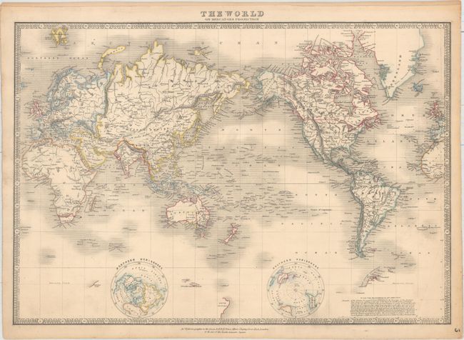
Beautifully and finely engraved with two polar hemispheres filling blank areas of the Southern Ocean and detailing the known geography of the polar regions. Antarctica is barely taking shape with most detail in the New South Shetland area. The map is centered on the Pacific Ocean and there is a remarkable amount of detail in the South Pacific with a myriad of islands delineated and named. Geographic detail is limited to major rivers, mountain ranges, and a few place names. In Australia, the states of South Australia, Victoria and New South Wales are named and delineated. British possessions are outlined in red. Surrounded by a keyboard-style border.
References:
Condition: B+
Original outline color with light toning and minor soiling.