Catalog Archive
Auction 158, Lot 355

Rare Thematic Map of Northern Serbia

"Comitatus Bacsiensis Ungarice Bacs-Varmegye et Germanice Batscher Gespanschaft...",

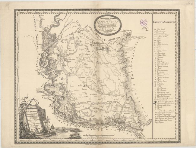
Subject: Northern Serbia

Period: 1793 (dated)

Publication: Cosmographischen Gesellschaft

Color: Black & White

Size:
22.4 x 18.3 inches
56.9 x 46.5 cm
Download High Resolution Image
(or just click on image to launch the Zoom viewer)

This rare thematic map depicts the very northern tip of present-day Serbia, bounded by the Danube River in the west, the Tisza River in the east, and extending south to Novi Sad. The area, previously known as the Hungarian region of Bacs, is shown in great detail. A key at right identifies 49 symbols used in the map, including fertile and sandy land, salt, wood, apples, wine, flax, mills, bridges, post offices, and more. The title cartouche features a river with a pastoral scene, fishing nets, and grape vines. Created by Joseph Marx von Liechtenstern and engraved by A. Amon.

References:

Condition: B+

A crisp impression on watermarked paper with light toning along the centerfold, one tiny separation along the centerfold, and an ex-library stamp at top right.

Estimate: $550 - $650

Sold for: $400

Closed on 6/22/2016

Archived