Catalog Archive
Auction 158, Lot 311

"[Lot of 2] Partie Septentrionale du Royaume de Portugal par le Sr. Bellin... [and] Partie Meridionale du Royaume de Portugal par le Sr. Bellin...", Santini/Remondini
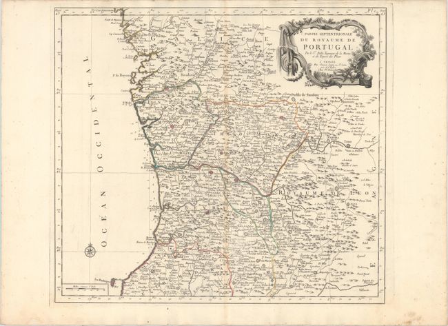
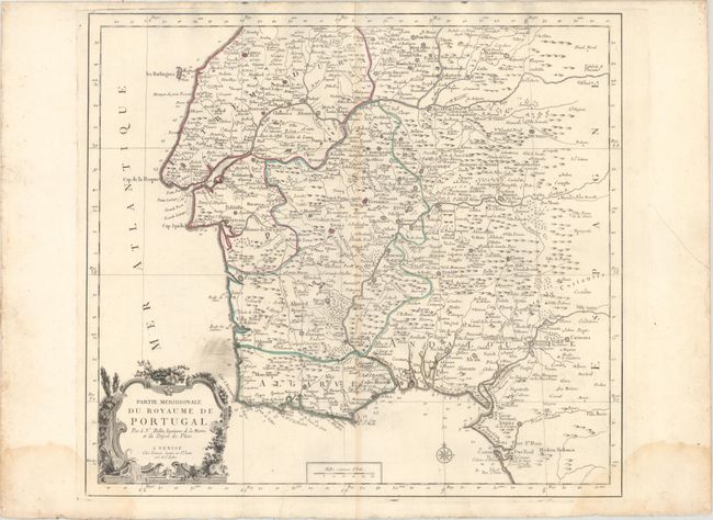
Subject: Portugal

Period: 1784 (circa)

Publication: Atlas Universel

Color: Hand Color

Size:
21.1 x 18.8 inches
53.6 x 47.8 cm
Download High Resolution Image
(or just click on image to launch the Zoom viewer)

Large-scale, attractive pair of maps that cover the whole of Portugal. The northern portion details the area from the Ulla River south to Leira and the Berlengas Islands. The southern portion starts at Leira, down the coast to Lisbon and Cape St. Vincent, and extending east to Cadiz. Both maps are made to stand on their own and have their own borders, rococo cartouches and scale of miles. Size varies slightly.

References:

Condition: B+

Nice impressions with original outline color on watermarked paper and light toning along the centerfolds. The southern sheet has an area of printer's ink residue above the title cartouche and light damp stains in the bottom corners of the sheet.

Estimate: $200 - $240

Unsold

Closed on 6/22/2016

Archived