Subject: Spain & Portugal
Period: 1635 (published)
Publication: Theatre du Monde ou Nouvel Atlas
Color: Hand Color
Size:
19.2 x 14.8 inches
48.8 x 37.6 cm
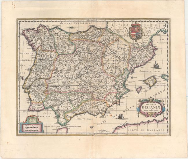
Blaeu's elegant map of the Balearic peninsula is filled with detail, including political boundaries, hundreds of cities, rivers, and mountains. The map extends to include the Balearic Islands and is handsomely embellished with two strapwork cartouches, sailing ships, and the Royal Arms. French text on verso.
References: Van der Krogt (Vol. II) #6000:2B.
Condition: B+
A crisp impression with full original color, light toning along the centerfold, a small rust stain adjacent to the lower ship, and an archivally repaired centerfold separation that enters 3" into map at bottom. There are some creases in the top blank margin and a 1" centerfold separation at top.