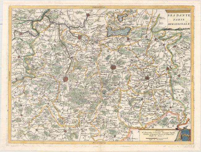
Subject: Central Belgium
Period: 1691 (circa)
Publication:
Color: Hand Color
Size:
23.9 x 17.9 inches
60.7 x 45.5 cm
This handsome map of central Belgium is centered just between Brussel and Leuven, extending north to Lier (just shy of Antwerp), south to Gembloux, west to Dendermonde, and east to St. Truiden. The map is fully engraved with roads, political boundaries, forested areas, and key cities depicted with miniature bird's-eye plans. The distance scale includes a dedication to Giovanni Cupilli.
References:
Condition: A
A clean and bright example with a crisp impression. A minor centerfold separation in bottom blank margin has been professionally repaired, and the top margin has been extended with old paper to repair two short worm tracks and to accommodate framing.