Catalog Archive
Auction 158, Lot 276

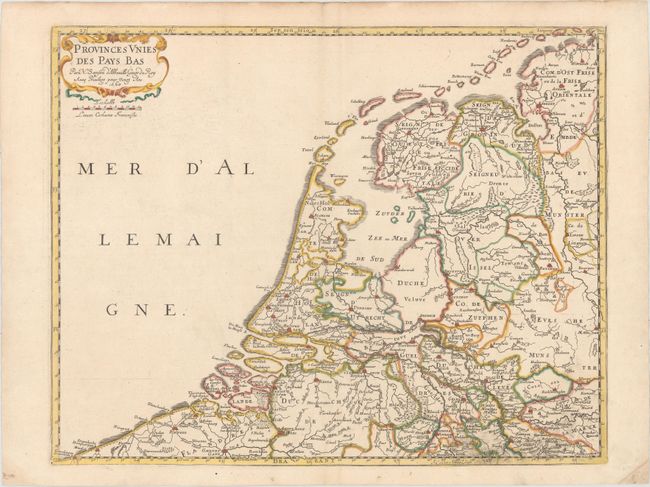
"Provinces Unies des Pays Bas", Sanson, Nicolas

Subject: Netherlands

Period: 1660 (dated)

Publication: Cartes Generales de Toutes les Parties du Monde

Color: Hand Color

Size:
20.1 x 15.9 inches
51.1 x 40.4 cm
Download High Resolution Image
(or just click on image to launch the Zoom viewer)

This map of the Netherlands focuses on political boundaries, rivers, and towns. The map extends south to Gent and Antwerp in Belgium and as far east as Dortmund and Munster in Germany. The North Sea is labeled Mer d'Allemaigne. Embellished with a simple strapwork cartouche.

References: Pastoureau, SANSON V B.

Condition: A

Watermarked paper with original outline color in the map and later color in the cartouche. There is some printer's ink residue at bottom right and minor marginal soiling.

Estimate: $425 - $500

Sold for: $230

Closed on 6/22/2016

Archived